Wednesday, March 25, 2009

Monday March 23rd Photos

Not sure if it will be worth a full report later down the road or not, but here are a few photos from the chase in central Kansas on Monday.

Initial supercell near Herington, Kansas.


Then it hit the after burners and left me in it's dust. Shot in Herington, KS.


Second supercell further south, near Fall River, KS.


Don't you hate when your road turns into this, without so much as a sign?


Video from the chase:

Monday, March 23, 2009

Kansas Moisture Return

Will be chasing central and southern Kansas today. Moisture is scaring me to death, but I can't resist the forecasted wind fields. Should storms manage to develop in the marginal moisture, they'll likely rapidly become supercells, with tornadoes a potential treat. Give me a solid 58F dewpoint and I'll be optimistic. Will likely start further north where convection has a better shot at initiation near the surface low, possibly near Salina. Then, should supercells develop along the dryline I'll continue to drop south to intercept.

Check the live tracker for position updates!

Thursday, March 19, 2009

Early Next Week

Still hedging between whether or not I want to make a long trip out west the end of this weekend or early next week. My current standing is not going. I'll keep watching the models to allow them to potentially persuade me otherwise. Outside factor that may persuade me to take the gamble will be the fact that I have the entire week off, and it will be hard to chase a three-day block again until mid-May.

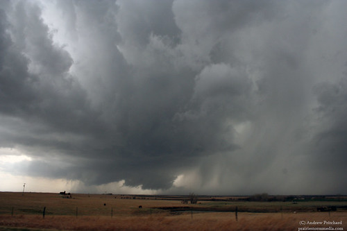
Day 1 of interest is Sunday. In some ways Sunday actually looks better than the "Big Talk" day of the week, Monday. Southern Nebraska is the "would be" target for Sunday. Doable moisture with td's in the upper 50's with excellent low level shear will boost EHI's to 2-3 in a bulls eye in SC Nebraska. The lack of upper level support is worrisome, but this event may lean more towards low-topped supercells so H5 level winds may not be as big a factor in this one.

Day 2 will fall on Monday. This day has been talked about by chasers in the plains for almost a week now. I can't seem to get excited about it yet. The early season factor is probably playing into the hype, as many chasers haven't seen such a dynamic system for many months, which may make the current prog's seem much more "perfect!" than they really are. H5 winds southerly and parallel to the dryline, td's only in the mid to upper 50s and only a narrow band of CAPE near 1000 j/kg are only a few of the limiting factors for this one.

Day 3, and probably the weakest of the setups (but the CLOSEST) is of course, Tuesday. The Iowa/Nebraska border shows some promise with this one, as does the much more unfavorable terrain of southern Missouri and Arkansas. This one is even further out than the others, so it's not worth nailing down specifics.

It's early in the year, so I'm trying to not blow a ton of money on a marginal setup built mostly on hype. Limiting factors aside, it IS a very potent system that needs watching. As stated, I'm going to keep the mindset of staying home, and go from there rather than allowing to convince myself that I should or need to go after this one. If I went, I'd like to try and hit southern Nebraska for a teaser but possibly fruitful day on Sunday, and then drop south to southern Kansas or Oklahoma on Monday for the linear convective mess.

Tuesday, March 10, 2009

Another iffy March Chase

Well, it's certainly not ideal but it's a short drive for me and my Tuesdays are very flexible, and since the long term models look very boring for a while I'll be watching. Now that I've convinced myself that I'm not TOTALLY wasting my time looking at data I'll get on with the forecast.

I'll likely be watching SW Illinois either along Interstate 55 near Litchfield, or slightly further south towards Highland along Interstate 70. Skies are more or less clear in southern Illinois and eastern Missouri ahead of the ejecting system. 0-3 km cape values will be around 125-175 j/kg in this area juxtaposed over areas of 300 m2/s2 low level helicities. With afternoon heating, we may even see surface capes try to reach towards the 1000 j/kg mark. Temperatures will likely be surging to the mid-upper 70s along Interstate 70 with dew points around 60. VV's really start spiking in eastern Missouri and western Illinois by 4 PM as convergence increases along the boundary. Hoping the strong forcing does not immediately lead to a forced line of convection, which it very well could. The plan will be to get on any storms pretty early while there is some discrete possibility.

Probably doesn't even qualify as a "good" setup, but I'll watch it and make the 90 minute drive should things start to juice up at all down there.

Monday, March 9, 2009

Potent Tuesday Setup

The models have been fluctuating back and forth a little bit on this one, but it appears a potentially volatile setup will exist across portions of Illinois on Tuesday afternoon and evening. A deepening negatively tilted trough with push into the midwest during the afternoon in conjunction with a very moist and potentially unstable air mass.

The day will begin with a large area of rain and thunderstorms across the central part of the state in advance of the warm front which can be a very sketchy way to begin a chase day. However, if played right this could aid in deepening the moisture in the area, and even lay out a boundary or two before peak heating sets in. Should the dry slot work in strong enough we could see substantial 0-3 km cape values to support low topped supercells in advance of the low and along the warm front in the warm sector across central and western Illinois. More severe storms will be possible along the cold front further south into eastern Missouri.

The extent of destabilization in the warm sector at this point is very unclear, but the potential for a potent afternoon is there. I'll be watching the area from Peoria to Quincy for now.

Sunday, March 8, 2009

Chase Today

I'll be heading out shortly for a gear testing chase op. Does look like some tornado threat with any isolated supercell that can maintain itself. 0-6 km bulk shear values on the order of 70 knots will support at least embedded fast moving supercells. Will likely head southwest soon to intercept supercells that should be on going near St. Louis by noon.

I will be testing live streaming most likely today. To check, look for my icon in Illinois on this page:

http://tornadovideos.net/full-screen-chaser-video.php

Saturday, March 7, 2009

Gear tester?

Checking the models for tonight, we may see a small shot at some severe thunderstorm activity in central Illinois tomorrow. The models had been wanting to speed the system into Ohio by mid-afternoon, but seems to want to slow it down for a bit which if true, would bode well for our chances at robust convection. It will take some convincing for me to believe this setup however, as it is fairly new on this run.

The most likely scenario we will see in central Illinois, is a continuation of the svr activity in Missouri at the moment in the morning hours with an attendant severe wind and hail threat.

Should the system continue to slow it's pace, we may see enough time for a clearing ahead of the surface low in the central part of the state by around the noon hour. Should this come to fruition, we will likely see marginal instability set into the area with sbcape values setting in around 750 j/kg2. Wind fields will strongly increase as the jet streak punches into the area mid-afternoon, with largely unidirectional wind fields ruling the day. However, near the warm front some backing in the lower levels will be present, and coupled with some diurnal heating could be enough for supercell structures. Any supercell that can form in this region would have at least a marginal tornado threat.

Looking further out, a more substantial threat seems to exist across the Mid-Mississippi Valley on Tuesday afternoon. The frontal boundary that is currently draped across the region will once again lift north as a warm front across northern Missouri, southern Iowa and Illinois. The models aren't very reliable at this point, but they are showing moderate instability along and south of this warm front and ahead of the newly developed surface low. Specifics are pointless at this point, but should a steady trend be realized in the models we could see a decent shot at supercell and tornado activity across that tri-state region on Tuesday evening.

I will likely be testing out the live streaming client that I'll be running in partnership with Tornadovideos.Net, and Weather Data Technologies, so check in for that.

Sunday, March 1, 2009

Happy first day of Meteorlogical Spring!

Got to ring in the first day of March late last night with some of my closest allies in the field as we met in Galesburg at Colin Davis' place for a little get together to ring in the "new year", as we see it. Though March doesn't always come through in a big way, it is more or less the kickoff of the season here in the midwest. While events may be more isolated than May or June, when March goes, it often goes big!

While I try and resist as the models are often very sporadic at this time of year, my eyes always poke a look at the 384 hour gfs every day or so. With things being all over the place, it's stupid to try and nail anything down but the upcoming pattern does show some promise. While I sit here looking out the window at sporadic snow flakes, it does seem the wind will soon shift from the north to out of the south, right over the beloved Gulf of Mexico.

By this weekend we should see our first shot of Gulf moisture, with a chance at some liquid precipitation, potentially in the form of thunderstorms! No major severe weather events show up on my radar, but the potential is going to be there in coming weeks as a change to a more moisture laden stormy pattern builds into the middle section of the US.

Here we go...?