
Here's a snippet from my forecast for NIU this morning dealing with the severe weather chances:
A thin line of showers and thunderstorms is possible along the cold
front as it approaches the area early tonight, which should bring an
end to the precipitation. Minimal instability levels will limit the intensity
of any storms that enter the area, though some heavy downpours are
possible, and this coupled with rapid melting of a decent snow pack
will lead to flooding in some areas. Further south in central and
southern Illinois, somewhat higher instability will lead to a higher
chance at a couple severe weather reports. The best threat
appears to be damaging winds, but if enough instability is
present a tornado or two is possible over the southern half
of the state. Instability is much lower than that of winter severe weather
outbreaks of recent years (January 7th 2008 and December 27 2008
to name a couple) so while the potential exists, I'm not expecting
anything too substantial. Wind shear is very strong in the
southern half of the state however, so any pockets of increasing
instability will need to be watched. Tornadoes have already been
reported with the supercell thunderstorms located in southern
Missouri, that at their current track and speed would be entering
Illinois around the St. Louis area around noon. Instability
will be decreasing through the day with eastward extend, so
an atypical weakening trend though the afternoon hours is
certainly possible. Again, this does not pertain to the immediate
DeKalb area, but being a major holiday during a time when many
are not expecting severe weather it's worth mentioning. I would say
areas south of Interstate 72 in central and southern Illinois should
remain alert for changing weather conditions and the possibility
that the storms in Missouri do maintain their current strength, while
areas north of Interstate 72 can expect to experience only garden
variety, but still perhaps heavy rain producing thunderstorms.
Friday, December 31, 2010
Thursday, December 30, 2010
New Years Eve thoughts cont'd
For now, it looks like things will be too far west for me to really
care about chasing prospects, but it does look like there is the chance for some winter fun around these parts, that doesn't involve snow.
I'll have family over for an extended family X-mas gathering,
and while I alerted them to the fact that I could not pass up stepping
out briefly for a December intercept, I won't be heading very far. If
we can get some clearing early in the day in west central IL I may be
interested. My eye is on the St. Louis area right now, if any.
Whether or not it's worth the trip for me will be figured out tomorrow afternoon.
Best case scenario for me is to head down 72 and intercept something
near Springfield, but I don't know how likely that is now. I think somewhere
along and near Interstate 70 in southwest / south central IL stands a
chance of a few after dark tornadoes tomorrow night. I expect storms
to initiate near St. Louis, eventually becoming widespread along the cold front
across much of Illinois producing potentially severe weather along and
south of I-80, and potentially tornadic over the area outlined above, in
southwest/south central Illinois.
Not likely a chase day, but certainly something exciting to watch in
late December.
Monday, December 27, 2010
Noisy New Years?
With a potent storm system entering the picture at the end of the week, my weather senses are beginning to tingle with the potential for some thunder in the mid-west! Here's an excerpt from my forecast discussion for northern Illinois:
"There should be a brief pause in the heavier precipitation later on
Thursday as we enter the warm sector of the system. That said,
abundant dense fog and some drizzle are still looking like a good bet.
Once the center of low pressure begins pushing into the Great Lakes,
dragging with it a sharp cold front we'll begin to see a return to heavier
precipitation during the day on Friday. The rate at which we can melt
off the snow pack on the ground (DeKalb currently has 13" of snow
on the ground) will determine just how warm we get ahead of this very
dynamic system. At this point, it appears that we should at least
reach the middle 40s by Friday evening. Remaining snow on the
ground, coupled with thick soupy cloud cover and heavy rains
could cap us off right there, but with such a potent system
it's not yet certain just how high we'll get. For that reason,
it remains unclear whether or not we'll see any thunderstorms
with the passage of the cold front. A vigorous system such
as this one certainly lends the possibility, but the amount
of instability that we actually achieve will be the deciding point.
Whether the sky is illuminated and the ground shakes is
up in the air, but a period or two of heavy rain is a safe bet."
Downstate in central Illinois, some thunder looks a little more likely as temperatures approach the middle 50s by Friday evening.
Below is the European solution for New Years Eve at 500 mb. In April, that'd have us talking tornadoes.

Also, in some of the holiday downtime, I took the liberty to go and visit a neglected chase day and share a few unseen photos. June 19 2009, Tia and I chased a supercell from right over Urbana into western Indiana. This was the day after my car was totaled driving to Iowa for a storm chase. I woke up knowing the chance for storms existed but frankly did not care. Tia drove me to the hospital to get some neck and back pain from the accident examined. Right as we got to the waiting room, I was texted by Mark Sefried informing me of a supercell heading right for us. The appointment went quickly, and Tia was up for a chase and was willing to use her car as the chase vehicle for the day so we were off. No data at all, not even a paper atlas. Just our eyes and a car. It ended up being a great chase, however! But, once we returned home, I was still not a happy camper after the situation in the 24 hours prior so I didn't do anything with the photos I took.
Oh yeah! I remember why. I missed documenting an apparent tornado that afternoon south of Danville, IL. Rapidly rotating wall cloud narrowed into a beautiful white funnel which apparently touched down just north of us. I didn't see anything on the ground though, and the ground contact could not have been more than a hundred feet from us as the funnel passed directly overhead. I realized when I returned home that the camera was on stand by. That's what I really wanted to see on top of the situation. Anyway, here are a few photos of the storm...
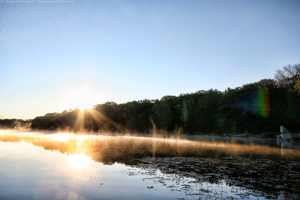
Early in the storms life cycle, just east of Urbana, IL.

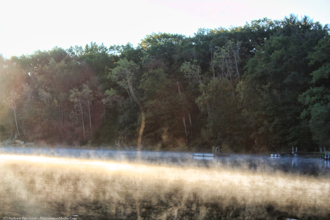
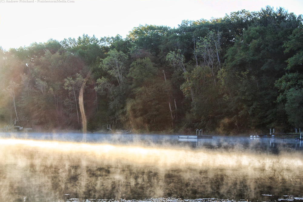
Crossing the border near Cayuga, Indiana.


Weakening now:

"There should be a brief pause in the heavier precipitation later on
Thursday as we enter the warm sector of the system. That said,
abundant dense fog and some drizzle are still looking like a good bet.
Once the center of low pressure begins pushing into the Great Lakes,
dragging with it a sharp cold front we'll begin to see a return to heavier
precipitation during the day on Friday. The rate at which we can melt
off the snow pack on the ground (DeKalb currently has 13" of snow
on the ground) will determine just how warm we get ahead of this very
dynamic system. At this point, it appears that we should at least
reach the middle 40s by Friday evening. Remaining snow on the
ground, coupled with thick soupy cloud cover and heavy rains
could cap us off right there, but with such a potent system
it's not yet certain just how high we'll get. For that reason,
it remains unclear whether or not we'll see any thunderstorms
with the passage of the cold front. A vigorous system such
as this one certainly lends the possibility, but the amount
of instability that we actually achieve will be the deciding point.
Whether the sky is illuminated and the ground shakes is
up in the air, but a period or two of heavy rain is a safe bet."
Downstate in central Illinois, some thunder looks a little more likely as temperatures approach the middle 50s by Friday evening.
Below is the European solution for New Years Eve at 500 mb. In April, that'd have us talking tornadoes.

Also, in some of the holiday downtime, I took the liberty to go and visit a neglected chase day and share a few unseen photos. June 19 2009, Tia and I chased a supercell from right over Urbana into western Indiana. This was the day after my car was totaled driving to Iowa for a storm chase. I woke up knowing the chance for storms existed but frankly did not care. Tia drove me to the hospital to get some neck and back pain from the accident examined. Right as we got to the waiting room, I was texted by Mark Sefried informing me of a supercell heading right for us. The appointment went quickly, and Tia was up for a chase and was willing to use her car as the chase vehicle for the day so we were off. No data at all, not even a paper atlas. Just our eyes and a car. It ended up being a great chase, however! But, once we returned home, I was still not a happy camper after the situation in the 24 hours prior so I didn't do anything with the photos I took.
Oh yeah! I remember why. I missed documenting an apparent tornado that afternoon south of Danville, IL. Rapidly rotating wall cloud narrowed into a beautiful white funnel which apparently touched down just north of us. I didn't see anything on the ground though, and the ground contact could not have been more than a hundred feet from us as the funnel passed directly overhead. I realized when I returned home that the camera was on stand by. That's what I really wanted to see on top of the situation. Anyway, here are a few photos of the storm...
Early in the storms life cycle, just east of Urbana, IL.

Crossing the border near Cayuga, Indiana.


Weakening now:

Wednesday, December 15, 2010
Geminid Meteor
Was it really only 4 degrees above zero the other night? I didn't notice.
I went out and braved the cold to capture some of the Geminid meteor shower that peaked on the morning of the 14th. I counted approximately 60 meteors in the one hour that I was out there. I had on enough layers to clothe a small village, and managed to stay fairly warm for the brunt of the hour that I was out. It was the feet that got me... once your toes and feet get cold there is no turning back. The conditions were perfect, and the meteors were beautiful. I didn't get the fireball that I was after, but I did manage to capture one decent meteor in with the star trails. There are several others in the photo below, but they were too dim to pick up with the Sigma 10-20. Need something that can do lower than f4.0 for that.
Looking like another 2-4 inches of snow here in central Illinois. I'm back in the Champaign area for the majority of the next month for the holiday semester break. I'm always anxious to get the spring semester underway as the days only get longer and warmer, and after a few weeks that first hopeless "slight risk" always pops up somewhere in the midwest. That day that you know you'll regret going for, but after a long and cold winter you can't help but lose sleep over. Only a couple months and change until what I consider the beginning of storm season. Nothing is fun to chase until early April, but as I always say, *someday*, that early season violent outbreak will show it's ugly face again, and I can only hope it's not the day I finally give up on the early season chase.

Beautiful water vapor illustration of the powerhouse storm system that brought the blizzard conditions to the midwest on Saturday and Sunday.

I went out and braved the cold to capture some of the Geminid meteor shower that peaked on the morning of the 14th. I counted approximately 60 meteors in the one hour that I was out there. I had on enough layers to clothe a small village, and managed to stay fairly warm for the brunt of the hour that I was out. It was the feet that got me... once your toes and feet get cold there is no turning back. The conditions were perfect, and the meteors were beautiful. I didn't get the fireball that I was after, but I did manage to capture one decent meteor in with the star trails. There are several others in the photo below, but they were too dim to pick up with the Sigma 10-20. Need something that can do lower than f4.0 for that.
Looking like another 2-4 inches of snow here in central Illinois. I'm back in the Champaign area for the majority of the next month for the holiday semester break. I'm always anxious to get the spring semester underway as the days only get longer and warmer, and after a few weeks that first hopeless "slight risk" always pops up somewhere in the midwest. That day that you know you'll regret going for, but after a long and cold winter you can't help but lose sleep over. Only a couple months and change until what I consider the beginning of storm season. Nothing is fun to chase until early April, but as I always say, *someday*, that early season violent outbreak will show it's ugly face again, and I can only hope it's not the day I finally give up on the early season chase.
Geminid meteor and about 30 minutes worth of star trails:

Beautiful water vapor illustration of the powerhouse storm system that brought the blizzard conditions to the midwest on Saturday and Sunday.

Monday, December 6, 2010
Tentacle like snow bands
Saved a quick loop of the radar out of Chicago, IL this afternoon that showed some very bizarre tentacle like snow bands passing over the area. Each one was producing snow that was not making it to the ground.
http://prairiestormmedia.com/dec6LOTbrefloop.gif
http://prairiestormmedia.com/dec6LOTbrefloop.gif
Friday, December 3, 2010
Snow update
Things becoming a little more clear with the snowfall totals across northern Illinois Friday night into Saturday. Looks like we're finally converging on what will likely be a swath of 3-4 inch accumulations with isolated 5-6 inch totals possible in the heaviest banding likely in northwest Illinois around the Quad Cities / Sterling area. The main swath of 3-4 inch totals should extend out of Iowa into NW Illinois from the Quad Cities to Rockford southeast toward Kankakee to Peoria. As the strength of the system wanes during Saturday morning areas downstate in central and eastern Illinois will receive lesser amounts, but will still be at the very least sweeping off their front porches by Saturday morning. I''ll go with more common 1-2 inches down there, with a few 3 inch reports possible along and north of Interstate 74 from Bloomington to Danville.
Snow should begin in northwest Illinois between 9 PM and midnight, and translate into north central Illinois and the DeKalb area shortly after. Central Illinois should begin to see their first flakes around midnight or so. It will take a while to saturate the very dry column, so while initially the radar may indicate snowfall, it will take a couple hours before snow begins making it's way to the ground in earnest.
I'll throw in the disclaimer that with such a dry powdery snow, any area that sees any period of banding/increased precipitation rates could easily stack up the totals quickly. I've done my best to outline where I think the best banding will line up at 24 hours out, but adjustments may need made once the action begins! I'll try to throw in another update once the evening model suite comes out.
Thursday, December 2, 2010
First accumulating snow
Looks like the first accumulating snowfall will glance the area over the weekend. Here in northern Illinois is looks like things will kick off late at night on Friday and carry into the day on Saturday.
Yesterday morning the models decided to go bonkers with snowfall amounts suggesting upwards of 10 inches, but have since calmed down to a more realistic scenario. Main killing factor seems to be the weakening trend with the H5 wave. Rather than the more amplified solution projected yesterday morning, a more subtle feature should sweep into the area and rapidly lose it's definition as it pushes over the area. This lack of upper level support seems to be the main instigator in the lesser snow totals. Initially as the dendritic zone becomes saturated it will remain above the more favorable omega layer, but over time into Saturday morning it should lower into a more favorable layer. Even with upper level support lacking this should instigate a period of fairly heavy snowfall over northern Illinois around sunrise.
It won't be the most organized system, but with a fairly dry snow things could accumulate quickly. Winds won't be overly strong, but again a dry powdery snow will let things blow around in rural areas through Sunday. Given QPF totals from around 0.3-0.5" and a dry snow ratio beginning around 12:1 and increasing upwards of 18:1 by Saturday morning, maximum totals of around 4-5 inches seem plausible in a narrow band. With large model spreads even only 36-48 hours out and the system not even onshore yet, nailing down the area of heaviest snow totals is pointless.
As is typical with me, I'm fairly excited about the first snow of the year. I'm generally okay with snow until about the end of January. By February as things start thawing out, I start getting that "February itch" to get out chasing and am about ready for frozen things to stop falling out of the sky, unless they're golf ball sized chunks of ice hitting my windshield as I search for tornadoes. So mother nature, you've got two months to get in all the winter storms you want so use your time wisely.
Tuesday, November 30, 2010
Top 10 Images from 2010
Well, it's been forever since I updated this guy as it's been a fairly quiet period. I should add that it's been quiet for me, as northern Illinois was recently whacked with a late season severe weather event resulting in a fairly decent tornado in the Rockford area. I however was out of town for the week leading up to Thanksgiving and missed out on all of this. You would think a five day period in late November would be a safe time to leave town and not miss out on anything severe weather wise but mother nature once again proves her dominance. I am forever at her will, but that's what keeps things interesting.
That all said, I decided it was late enough in the year to go through my entire collection of images from 2010 and throw out my top 10 favorites. They aren't strictly limited to the warm season severe weather events, and there are certainly a few that probably could have made the cut that did not. However, on this day, at this hour, these are the ten images I feel are the best that I have taken this year in no particular order.


October 24 2010 - McLean County Illinois. Late season severe weather opportunity never really presented itself to the desired magnitude, but thunderstorms did erupt along a cold front just after sunset. I positioned myself in front of a cluster of on-again-off-again severe warned cells just west of Bloomington, IL and again was treated to an amazing twilight lightning display. The moon was even peaking up in the east giving me frontlit moonlighting, purple twilight, and lightning underneath with the stars shining above.

While the October 26 2010 super storm didn't produce much in the way of photogenic weather, the aftermath was certainly worthy. I ventured out to the damage path of an EF-1 tornado that struck a couple farmsteads northwest of Elburn, IL in Kane County where I shot this image. Even weak tornadoes can produce some impressive scenes.


July 17 2010 - Champaign, Illinois. This was a pretty fun non-chase. I shot a time lapse of this guy pulsing up and down for almost two hours across the Illinois/Indiana border. Once the sun set it looked like the show was over, but another pulse shot right up and this thing became electrified. One of the few times this year that I took the super-wide angle lens off.

June 4 2010 - Western Illinois. The day before the big day in western Illinois we caught this beautiful non-tornadic supercell just south of Macomb, IL. While it never looked overly close to producing a tornado this was one of the more fun chases I had this year. It was as relaxing a chase as they come.


August 15 2010 - Deep Lake, Wisconsin. I hit the star trails hard this year, and it finally paid off at the lake this summer. After being cut short by clouds two nights in a row before, I finally snuck in a much longer sequence getting some huge streaks in the sky. This was on the days following the Perseid meteor shower, but I didn't manage to catch much in this image though I did note a few out of frame while shooting.
That all said, I decided it was late enough in the year to go through my entire collection of images from 2010 and throw out my top 10 favorites. They aren't strictly limited to the warm season severe weather events, and there are certainly a few that probably could have made the cut that did not. However, on this day, at this hour, these are the ten images I feel are the best that I have taken this year in no particular order.

September 12 2010 -DeKalb County Illinois. Elevated convection worked its way across northern Illinois during the evening, one storm even going severe warned in the northwest portion of the state earlier in the day. By the time I intercepted the storms on my way back into DeKalb they were nothing more than elevated thunder showers. Hardly even any precipitation falling from the bases, but enough juice for intermittent bolts of lightning to snake around underneath. Right around twilight, the scene was almost surreal.

October 24 2010 - McLean County Illinois. Late season severe weather opportunity never really presented itself to the desired magnitude, but thunderstorms did erupt along a cold front just after sunset. I positioned myself in front of a cluster of on-again-off-again severe warned cells just west of Bloomington, IL and again was treated to an amazing twilight lightning display. The moon was even peaking up in the east giving me frontlit moonlighting, purple twilight, and lightning underneath with the stars shining above.

While the October 26 2010 super storm didn't produce much in the way of photogenic weather, the aftermath was certainly worthy. I ventured out to the damage path of an EF-1 tornado that struck a couple farmsteads northwest of Elburn, IL in Kane County where I shot this image. Even weak tornadoes can produce some impressive scenes.

April 4 2010 - Leroy, IL. This might be the best lightning photo I've ever taken. Tornado watches were out early this Easter Sunday but I stuck with family commitments. I was rewarded with this image as I intercepted a severe warned (previously tornado warned) supercell as it entered Leroy in McLean County on my way back to DeKalb that night. While impressive looking moving in, the storm's core had nothing to show in the way of severe weather.

July 17 2010 - Champaign, Illinois. This was a pretty fun non-chase. I shot a time lapse of this guy pulsing up and down for almost two hours across the Illinois/Indiana border. Once the sun set it looked like the show was over, but another pulse shot right up and this thing became electrified. One of the few times this year that I took the super-wide angle lens off.

June 4 2010 - Western Illinois. The day before the big day in western Illinois we caught this beautiful non-tornadic supercell just south of Macomb, IL. While it never looked overly close to producing a tornado this was one of the more fun chases I had this year. It was as relaxing a chase as they come.

May 22 2010 - Aberdeen, South Dakota. A day that I often try to forget for missing the Bowdle, SD EF4 tornado, I was just in a hurry to get to my reserved hotel room in Sioux Falls another two hours south of here and forget the day. I kept glancing up at the beautiful mammatus display above me and thinking I would kick myself if I didn't stop and at least shoot one photo. I could have been more creative in my composition, but angry as I was all I could muster was pulling off on a small side road and snapping this photo looking down the road to my south.

May 10 2010 - Wakita, Oklahoma. This tornadic mesocyclone was absolutely churning away in the sky as it passed to our north. Seconds before this image was taken a fully condensed tornado could be seen to the left of the road. There were certainly severe small tornadic circulations underneath this base as it rotated away. Watching video of this scene you'd swear it was time lapsed.

January 19 2010 - DeKalb County Illinois. Two straight days of thick freezing fog smothered northern Illinois. I went out the day before this shooting some of my favorite winter weather images as a thick soup of fog froze onto every surface imaginable. However, those images would be topped the next morning as the fog lifted and a deep blue sky emerged atop still frozen vegetation.

June 18 2010 - Shabonna, Illinois. The day after I sat out the biggest Minnesota tornado outbreak in years, I was treated to a minor consolation prize as two severe bow echos traversed the home land. I timed it just right to catch this beautiful almost blue shelf cloud go overhead at my favorite place in the world (the DeKalb wind farm) just as daylight faded away. The early afternoon bow echo produced much stronger winds, but it's passing was dwarfed by the graceful shelf cloud that preceded this weaker line.

August 15 2010 - Deep Lake, Wisconsin. I hit the star trails hard this year, and it finally paid off at the lake this summer. After being cut short by clouds two nights in a row before, I finally snuck in a much longer sequence getting some huge streaks in the sky. This was on the days following the Perseid meteor shower, but I didn't manage to catch much in this image though I did note a few out of frame while shooting.
For those of you counting, yes, there are 11 images in my top 10.
Thursday, November 4, 2010
Lake Michigan enhanced convection last night
I wanted to quickly point out some interesting occurrences over Lake Michigan last night. As a blast of cold air came down out of Canada and chilled surface temperatures into the 30s across surrounding coastal areas of Lake Michigan, the water surface temperatures remain in the middle 50s. This warmer surface temperature, coupled with much colder air blasting down aloft created an area of enhanced low level instability over the lake, very similar to what we would see in a lake effect snow event. You take that cold air mass aloft and lift it over the already cold 35F temperatures of the land surface and your temperature change with height as you go up is negligible when it comes to achieving any kind of instability, and unable to support convection. However, take that same cold air mass and move it over the water surface, which is about 20F degrees warmer than the land, and suddenly your low level lapse rates increase rapidly.
A few convective cells were able to tap into this area of enhanced low level juice and maintain themselves for quite some time as they passed SSE across the lake, even producing lightning at time, and showing the possibility of some small hail production.
I archived a couple meso-analysis maps, as well as a radar image of one of the more intense cells occurring a little before midnight.
Radar image of the storm over SE Lake Michigan. The green triangle indicated the potential for some small hail in the updraft.

Low level lapse rates bullseyed over southern Lake Michigan at 8 degrees C/km.

And then the lifted index maxima over the same area.

RUC analysis also indicated the possibility of surface based cape of 300-400 j/kg in the same area.
The storm quickly vanished as it moved ashore into the colder surface temperatures where instability was null.
Wednesday, October 27, 2010
Elburn, IL Tornado Damage from October Super Storm
Well, the event ended up being a bust for me personally severe weather wise, but storms did cause significant damage in Illinois, and surrounding areas. Back in Champaign, a significant microburst removed portions of a roof from a home, and created havoc in the neighborhood. I'm sure estimated wind speeds will come out of that event as near or just above 100 mph. Just 10 mile away from DeKalb, an EF1 tornado damaged a couple farmsteads NW of Elburn, IL in neighboring Kane County. I went out during the evening to survey the damage. Most of the damage was limited to farm houses and other outbuildings, but one home that was directly in the path of an exploding barn suffered some damage from flying debris.
I put up a video with some clips of the damage, but personally think the photos below tell a better story. For video lovers, here you go. I suppose the high winds in the background a pretty neat:
http://www.youtube.com/watch?v=LjcAcsHPEbo
Here's the flickr set of images: http://www.flickr.com/photos/prairiestormmedia/sets/72157625249607212/


Monday, October 25, 2010
Convection at dusk last night / tonight's wind
Went out on a "chase" yesterday that ended with a post-sunset intercept of some sub-severe convection near Bloomington, IL. Things looked decent for a couple supercells yesterday evening, but it was unclear if things would go before dark. Being a weekend, I decided to go for it since I was already in the target area of central IL. I left Champaign around 3 PM and made it to my Springfield target where I met up with Jarrod Cook, Mark Sefried and Mike Brady. We shot the breeze for an hour or so before the sun started getting lower on the horizon. Cells began popping up right at sunset, and were lining up along the drive home so we hit the road. I figured if anything went nuts I could easily pull off and shoot lightning photos.
Just as the last little bits of twilight were fading away a cell to my west started to organize, and began spitting out frequent enough lightning that I decided to pull off at the Hudson, IL exit along Interstate 39. I shot this little broken line of storms for probably an hour before they lost their photogenic appearance. With the remaining twilight behind the storms, a nearly full moon front lighting them, and city lights giving off a red glow and the lightning provided by the storms it was a photographer's dream. It's situations like that which almost make the camera operators job easy. All I had to do at that point was set up the camera and keep shooting.
The next 24 hours look very interesting in this region. It's not an ideal tornado chasing setup, but my meteorological senses are getting tingly all over for several reasons. The extreme storm system is expected to bomb out over the Minnesota and Canada border sometime tomorrow with a forecast low of 960 mb, which would rank it among the strongest in recorded history in this area. That alone will cause gradient surface winds of the likes that we have not seen in years. Surface gusts could hit 60-70 mph tomorrow afternoon in Wisconsin and northern Illinois as the dry slot wraps around the system, behind the cold front.
The cold front is another story, as it may bring with it a fast moving round of severe weather. I'd like to get excited about the tornado prospects, as I do think there will be a few tornadoes in central/northern Illinois into Indiana tomorrow, likely early in the morning. However, even if tornadoes do occur, almost everything is against one actually seeing it unless you are unlucky enough to actually be hit. The storms could very well pass through this area very near, or even just before sunrise which would obviously cause any tornado to be hidden by darkness. I don't expect a lot of lightning with the storms, so while night chasing in general is dangerous enough due to your inability to see the tornado, any tornado that strikes before sunrise tomorrow will be almost undetectable aside from radar, which will be hard enough in itself. Then, you add storm motions. Let's say an embedded supercell does begin producing tornadoes. You better be directly in the path of that thing right as it produces, because once it passes you up, at 60 mph the storm has passed you up and your chase is over. Then, you add the embedded nature of the tornado. See my video from the August 19 2009 tornado near Rochester, IL. Let's say you DO get near an in progress tornado. Congratulations, you've passed most odds. Now, can you see it?
The odds are any tornado that occurs tomorrow will not only be fighting daylight, and moving at 60 mph, but it will likely be partially or entirely obscured by rain. The best case scenario, is that isolated/scattered supercells form along confluence bands ahead of the main squall line and you're able to catch a view of one of those potentially classic supercells. However, I think this is a pretty unlikely scenario tomorrow unless some changes take place to the overall synoptic setup. If we end up with supercells ahead of the main squall line, we need to start talking historic tornado outbreak. I'm personally not ready to do that, but the overall "we've never seen anything like this" nature of the storm has my senses tingling, and my interest peaked.
Then, once the squall line of doom passes the area, the dry slot wraps around and we spend a good 12 hours in insane surface winds. We'll probably be seeing sustained winds above 40 mph for a couple hours, and I won't be shocked at all to see an 80 mph wind gust somewhere in Wisconsin or northern Illinois tomorrow afternoon.
I'm not planning a chase, per say at this moment. However, I'll be watching the event closely and will intercept whatever does occur that I feel I can do so safely, and with a potential reward. I'm not in to driving a ton of miles on a Tuesday for video of sideways rain, but should I feel my odds of photographing a tornado, or perhaps insane winds is decent, I have not put away the chase gear after last night's storm.
Flickr set with higher quality images: http://www.flickr.com/photos/prairiestormmedia/sets/72157625114217711/


Sunday, October 24, 2010
Isolated tors in the Land of Lincoln today?
Looking like a pseudo-surprise chase day today in central Illinois. Only a pseudo-surprise because I knew the potential was there, but it looked marginal at best until this morning. Even when I woke up this morning I was fairly negative, but as the day has progressed over just the last two hours I'm feeling much more optimistic about a couple supercells, and even a tornado report or two across west-central Illinois this afternoon. I've got a fairly board target right now, but since I'm in Champaign for the weekend, things will generally be moving this way so I can hang tight and let things unfold. Watching the Springfield to Litchfield area right now, which will eventually move towards the Decatur to Effingham area this evening.
Abundant sunshine and howling south winds right now... how long has it been since we had that on a potential chase day? RUC forecasts have plenty of 0-3 km cape all along the I-55 corridor from St. Louis to Springfield, and even perhaps as far north as Bloomington. Lapse rates in the low levels are very steep. Keep this sunshine going and we could get some low topped storms to erupt along Interstate 55 by around mid-afternoon. It would be nice if we could get surface winds to back to SE in advance of the wave, but I'll settle for southerly. Should be sufficient for at least a couple low topped supercells, and perhaps a tornado or two with the dominant storms.
I'll try to post as updates come along, but for right now I'm eyeballing leaving Champaign at 2 PM with a starting point of Springfield.
Tuesday, October 19, 2010
Hole punch clouds / Russell Woods
Just a brief post as I don't have a lot of time, but had a couple things I wanted to share.
First, and most recent was this evening when we had a couple "hole punch clouds" over the skies in northern Illinois and surrounding regions. I was indirectly alerted by a Facebook post by Scott Weberpal over southern Wisconsin that he had seen a couple this evening. I decided I'd keep my eyes on the sky as we're not overly far apart. In walking home from the grocery store with Tia just after sunset I actually spotted a couple moving overhead. After dropping the groceries off in the house, I hopped back out to the driveway and snapped a shot of them. They aren't the most textbook example, but still a pretty cool thing to see!
Here's a decent explanation of their formation: http://weatherthings.com/HolePunch.html

Last evening I decided to get out and enjoy a pleasant evening with a rive to Russell Woods, outside of nearby Genoa, IL. It's only an easy 15 minute drive away so I figured it was worth checking out. I didn't have a lot of time before sunset, but it seems like a neat little place. I left the beaten path and explored the deep woods in search of some remaining sunlight to try and capture some fall colors. I didn't find a lot, but did find some hunter's metal elevated platform and decided to give it a climb, which gave me a decent view of the setting sun over the golden cornfields.
Kind of blurry because silly me, did not bother to use a tripod for shit shot.

View from high atop my newly acquired tree top observatory.


Snapped a quick shot of my observatory before I left.

Wednesday, October 13, 2010
Camping + Chasing
I made a post regarding the topic of camping while storm chasing on my personal facebook page a couple weeks ago, because as time progresses I'm getting more and more gungho about camping in general, and specifically camping while on the road storm chasing. Several storm chasers I know have done this, and for some it was simply the only way they chased. Most of them cited getting older and having more disposable funds to pay for a hotel at the end of the night as the reason they do it less now, or not at all. But hey, I'm a broke student and the idea of roughing it sounds like a blast, so it seems I'm in the prime for getting started.
Wisconsin is what started this all off. There is plenty of space to sleep indoors up there, but this summer I said the hell with indoors, I'm sleeping outside. Tia as always was a sport and humored me on this one knowing how bad the ticks were this summer and that we'd be in the 90s during the day. I promise I vocalize my appreciation for her every single day. We ended up borrowing a tent from her family and were on our way. It ended up being a blast for the most part. The only stumble if you will, was on the final night when a thunderstorm complex hovered around the area. I initially said we'd be fine (and we ended up being just that) but in laying there awake surrounded by little pieces of heaven with the wind blowing through the trees and frogs croaking down by the lake the lightning continued getting more vivid and the thunder a little louder each time. Eventually we decided to call it and head indoors. But first, out of consideration for Tia's family I decided that I wouldn't allow their tent to blow away in a storm and that we'd take it down before heading indoors. Not having contacts in and the dark of night made that a real treat, and Tia managed to get not one, but two ticks on her in that short time but we came out alive.
In the end, how can you really beat this? I posted it before, but here is Tia and my sleeping spot for the Memorial Day weekend:

But now, we're armed and ready. Over the summer I became more and more gungho about doing this more often, and in more places. I decided that I needed a tent of my own, and wound up picking up this sweet Coleman Sundome 4 for about 20 bucks cheaper than normal in a sale at Farm and Fleet here in DeKalb. I picked up a bunch of other camping odds and ends, and by the end of the trip I was armed and ready for some camping domination. Now, if only we were not plowing headstrong into winter. I should add I also ordered an all-terrain air mattress that received rave reviews. The all-terrain label really only suggests it's a little tougher against holes and leaks, but it was also given great comfort ratings. It didn't cost any more than the non-all-terrain, so why not?
My digs for spring/summer/fall 2011:

In becoming gungho for camping in general, I've been thinking more and more about the idea of camping while I'm on the road storm chasing. The price of hotels (hotels that won't make you queezy when you walk in the door, and wary to lay any part of your body anywhere) are a chase killer for a college student chasing primarily solo. I will easily talk myself out of wanting to take a risk on a distant day when it becomes an issue of "Can I make it back home without stopping overnight?" When the answer to that question becomes a 'no', you can add about 65 bucks to your chase price tag unless you manage to meet up with others and split the costs. That's not an assumption I want to make going into the day, however. If I can find somewhere to sleep for FREE, then the chase or don't chase decision becomes a lot easier. To some, it's not worth giving up a hot shower and a comfy mattress, but to me the change is not all that hard to make and in the end I'd almost prefer it this way. It should be obvious enough through my photos that not only do I love severe weather, but I love nature in general. I love the wide open. Okay, so it doesn't have to be wide open so long as I'm enclosed by walls of trees and other naturally occurring boundaries. Winter kills me because I can't get out there and away from civilization. I will never be a city dweller because I simply can not be around urbanization too long without going crazy. My cabin fever not only extends beyond the walls of my home, but to the outreaches of the last building on the edge of town. To be able to plop myself down under the open sky in mother nature's guest bedroom after a storm chase only brings the entire experience full circle.
There are a couple obstacles that come along with this idea, namely inclement weather. However, in the great plains it's generally fairly easy to drive 50 miles or so to the west beyond the threat area and be sleeping easy for the remainder of the night. Should a storm arise in the middle of the night where I lay, I can easily toss everything in my car and ride the storm out. Perhaps to some this seems nuts and beyond the worth of saving money, but to a college student's wallet who NEEDS to chase that moderate risk the next day, an extra two tanks of gas in my wallet is a necessity.
I don't know - I'm just getting more and more antsy for this coming spring and summer thinking about riding around all day looking at beautiful stormy skies, before plopping down a tent and falling asleep under a star filled sky listening to nature, and then waking up in the morning to the sun in my face before doing it all over again. Storm chasing aside, I'll definitely be hitting up the camping scene A LOT next warm season. What a freaking great way to explore the mid-west when the storms are absent. I'll just spend the winter getting more and more gungho and really annoying about my new found love for camping.
Sunday, October 10, 2010
Delayed Wisconsin stuff!
Well, I decided to make the steam devil stuff my priority and quickly got that stuff on the blog - but during a busy week quickly forgot about anything else. I was lucky enough to have the steam devil stuff featured on both SpaceWeather.Com, and Wired Science Magazine - thanks to them!
I meant to get a few of the other non-steam devil photos up from last weekend in Wisconsin. The trip ended up going perfectly, even if the weather was iffy at first. Leaving DeKalb under sunny skies and temperatures in the middle 70s, things looked great! However, and I knew it was coming - we punched through the cold front that had been waiting for us on the Illinois/Wisconsin border and were greeted by howling winds and a rapid drop from 70F to 52F by the time we arrived at the lake. Dealing with a completely saturated ground (which is all sand up there) and howling 45 mph winds there was no way the newly purchased tent was staying up. After combating the elements for a half hour, I managed to get the tent upright but as mentioned, the wet soil and howling winds weren't having it so I quickly packed things back up and we moved indoors.
We awoke to beautiful sunny skies and cool, but refreshing temperatures. Scott Weberpal joined Tia and I around noon and with a fire in the fireplace we enjoyed some good ole college football. The Wisconsin game ended up being blacked out by DirecTV so we marched over to Parker Lake Lodge and enjoyed the game with some good company, including a group of cyclists that had just finished biking from Chicago.
That evening Scott and I hit the lake in the row boat where he armed himself with the fishing arsenal, and I armed myself with the camera arsenal. We were accompanied by rather good sized fish leaping at times five feet into the air and flopping back into the water. I'd never seen anything like it on that lake before. It resembled the Asian Carp, of the Illinois River. Unfortunately, after a cold front passage all Scott could muster was an 8 inch or so northern pike that fell off his line before any photo could be taken.
Sunday was supposed to be the first frost of the season with temperatures plunging below freezing. I knew the lake temperature was still in the middle 60s so I figured plenty of lake steam would be present. Well, you all know the rest.


I feel like I've still got plenty of ramblings, but I'm just lacking the verbal creativity at this moment. This was hard enough in itself to plug out, but the photos were long overdue.
I meant to get a few of the other non-steam devil photos up from last weekend in Wisconsin. The trip ended up going perfectly, even if the weather was iffy at first. Leaving DeKalb under sunny skies and temperatures in the middle 70s, things looked great! However, and I knew it was coming - we punched through the cold front that had been waiting for us on the Illinois/Wisconsin border and were greeted by howling winds and a rapid drop from 70F to 52F by the time we arrived at the lake. Dealing with a completely saturated ground (which is all sand up there) and howling 45 mph winds there was no way the newly purchased tent was staying up. After combating the elements for a half hour, I managed to get the tent upright but as mentioned, the wet soil and howling winds weren't having it so I quickly packed things back up and we moved indoors.
We awoke to beautiful sunny skies and cool, but refreshing temperatures. Scott Weberpal joined Tia and I around noon and with a fire in the fireplace we enjoyed some good ole college football. The Wisconsin game ended up being blacked out by DirecTV so we marched over to Parker Lake Lodge and enjoyed the game with some good company, including a group of cyclists that had just finished biking from Chicago.
That evening Scott and I hit the lake in the row boat where he armed himself with the fishing arsenal, and I armed myself with the camera arsenal. We were accompanied by rather good sized fish leaping at times five feet into the air and flopping back into the water. I'd never seen anything like it on that lake before. It resembled the Asian Carp, of the Illinois River. Unfortunately, after a cold front passage all Scott could muster was an 8 inch or so northern pike that fell off his line before any photo could be taken.
Sunday was supposed to be the first frost of the season with temperatures plunging below freezing. I knew the lake temperature was still in the middle 60s so I figured plenty of lake steam would be present. Well, you all know the rest.
The rest of Sunday ended up being a beautiful day without a cloud in the sky. Excluding the debacle that Friday night was weather wise, it was a perfect fall getaway.


Mr. Weberpal giving a face as he awaits that first "bite".


A perfect October evening on Deep Lake.

The morning of the steam devils. Hard to be this. Nothing but myself and the row boat under me making any noise except for the birds.

She won't win any beauty prizes, but this thing has certainly served it's purpose for many a year.
I'd sure trust it over the row boat with camera gear strapped around my neck.
I'd sure trust it over the row boat with camera gear strapped around my neck.

Another hard to beat - the peace and serenity of a middle of nowhere lake, some spicy sausages on the grill, and the lovely Tia standing by with a book in hand.

Tia and her buddies sharing one last moment before the lake freezes over.


I feel like I've still got plenty of ramblings, but I'm just lacking the verbal creativity at this moment. This was hard enough in itself to plug out, but the photos were long overdue.
Monday, October 4, 2010
Steam Devils over Deep Lake
I ventured up north for an early fall weekend get-away to my family's lake house in Wisconsin this past weekend. With the first freeze of the season forecast as temperatures plunged to at or just below 30F and the lake temperature still in the lower 60s I figured photogenic morning steam would be a sure thing. I ended up with that and more, as steam devils, or little vortices in the steam started sprouting up around sunrise. Essentially these guys form under the same conditions that drive dust devils, as well as water spouts and land spout tornadoes, on a much much smaller scale of course.
Little areas of vorticity would be present as the very light winds roll the steam across the lake surface, while little updrafts due to the instability in the lowest of levels stretches the vorticity into at times tight little circulations in the steam. Pretty mesmerizing stuff to watch as they really do resemble little water spouts. I ended up almost core punching one on the row boat just after sunrise and noticed they even created little "swirl" regions at the surface of the water and base of the vortex, exactly as water spouts do. Unfortunately this was too difficult to actually document visually.
I managed a few decent photos, and composed a short video with some clips of some of the more interesting circulations. Unfortunately I hadn't planned on documenting anything interesting video-wise over the weekend so I left the HD camera at home and just had the little back up SD video camera. Better than nothing, I suppose.
For the video, I recommend actually clicking the link and opening in a new, larger window to be able to see some of the more subtle circulations.
http://www.youtube.com/watch?v=DuXK_tTq2lg
There are actually quite a few circulations all in a line in that top photo.

For now I'll leave it at the steam devil stuff, but I've got plenty more to update on from the weekend that I'll save for a time that I'm more alert and coherent. I tried again for steam devils this morning at sunrise after arriving home late last night from Wisconsin and am now pretty crispy. Plenty more photos and other ramblings to come, however.
Tuesday, September 21, 2010
Photos from tonight and last
Short on time for words, but wanted to get a couple photos up from the not so eventful outing earlier this evening as well as a couple from last night. Feeling like I've neglected the main site (oh yeah, I have one of those!) and probably going to do some updates around there cosmetically.
As always - my favorite place for relaxation in the DeKalb area. I actually got to witness this guy kicking on the turbine's automatic braking mechanism. When winds reach a certain point, which the surface flow did do today (well, several hundred feet above the ground for these guys) the braking mechanism kicks in which rotates the blades to a certain position so they don't catch the wind and will barely move even in the most howling of winds. I was just relaxing looking up some data when I heard a really loud whooshing noise and looked up. Turned out it was the turbine's blades turning into the wind as they rotated around to the off position. Pretty cool stuff, if you've got a mad crush on the wind farms as I do.


Huskie Stadium on the Northern Illinois campus. Went to the Illinois vs. Northern Illinois game down in Champaign to root against my life long favorite team. Excellent football game, but wish NIU could have finished them off.

Myself and old yella. First real shot with the new black grille after the pheasant took out the yellow grille in South Dakota back in May. I like the black better... more contrast and a meaner look. I guess.

Subscribe to:
Posts (Atom)


