Monday, February 28, 2011

Overlooked photos finale

Hard to believe I overlooked this one way back when, but I did. July 21st 2008 was simply a lightning chase. I'd played restaurant league softball for the better part of the evening know that there was almost a 100% chance of explosive convection along a boundary after dark. Sure enough, around sunset towers began exploding as severe storms erupted in central Illinois.

I initially went northwest along Interstate 74 toward Peoria, but given convective trends I detoured at Mahomet and caught Hwy 47 south toward the Monticello, IL area and stopped there. I then spent the better part of the night sitting there alone in a cornfield with lightning strobing all over. At one point, the anvil crawlers became epic. If only there was a time in my past that I had the wide angle lens that I do now.

Anyway, here's another in the top 5 moments that I am at my happiest - mid-summer in a corn field all alone with lightning surrounding me.

Dekalb Coaling Tower Circa 1900

Got a phone call late at night over the weekend from Gilbert Sebenste saying he was heading out in the freezing drizzle to stand outside for a couple hours. How can one refuse an offer such as that? The goal was to check out an observing park on the Union Pacific line in the industrial region of southwest DeKalb. My cabin fever is about off the charts right now, so I accepted his offer. Immediately this old coal tower caught my attention and I was in love. I don't know what it is about really old stuff, but that abandoned house I shot last week, and now this old massive structure along the rail line that was probably built around 1900 are just so fun to shoot. They really do all the work for you.

Looking east down the UP line toward Chicago with the awesome old structure in the center. Hard to believe that thing was built around 1900 and is still in structurally magnificent condition. They just don't build things like they used to!


Probably the best graffiti I have ever seen. After thinking about it I could have sworn I had seen this before. I came home and 'googled it' and found out that it is in fact based on a sketch by comedian Demitri Martin.


Train coming westbound now with his high beams illuminating the freezing drizzle. This was the only shot that I had that wasn't screwed up by all the tiny water droplets on my lens.

Going eastbound now.
The best part of the night came at the end. About half an hour before I had spotted this coyote running around by the lake on the other side of the trees. We watched him for a while before we lost sight of him. Well, just as we are packing up to head home he comes into view. He was checking us out slowly as we watched him. He held still long enough that I wondered if there was any way I could get a halfway decent photo of him. I slowly switched from my wide angle 10-20mm to my crappy 18-55 kit lens. He was still behind some bushes and a good distance away so I slowly and quietly crept back down into the clearing where I had a nice open shot of him and set up my tripod. Low and freaking behold, he just comes trotting over like my own dog would do in our backyard. It was the damndest thing. He came to a stop about 15-20 feet away and just began posing for the camera. I was working incredibly fast because I didn't know how long he would hold still, and that combined with the crappy lens led to a terrible quality photo - but you can definitely get a nice view of this amazing little guy.

I run into coyotes all the time in doing my night photography sessions, but never in those times have I had one just come jogging over to me. Coolest and momentarily very intimidating. As I stood looking through my lens as he jogged over toward us I quietly asked Gilbert if we should perhaps be moving the other direction.


While shooting his photo, we caught the attention of one of the DeKalb police officers. He pulled up in the parking lot and shined his hand lamp over on us and watched for a few minutes. It was pretty obvious what we were doing (and probably best that we weren't near the tracks anymore) and he eventually left.

That's when we caught view of the coyote again! He had now wandered out onto the ice and was giving a flock of geese some fits! They were sitting safely in a melted patch of water, but the coyote trotted around the flock as if to say that they better not venture to solid ground or he'll be catching a late dinner.

Probably one of the most bizarre night photo outings I have had and only had to travel a mile away from home. Being so close, I can definitely see myself biking out there a few nights this spring to play around with some new angles. Since I will likely only be in DeKalb for another year as I finish up my B.S. I want to get out and explore the town so I can say I've seen it. There seems to be a ton of history hidden around town (that big coal hopper for example) mostly related to the railroads. I figured a fun way to check out the city before I leave would be to just head out on my bike and ride around in a new area each time and photograph the neat little things that I find. Once I'm done with school here, there will probably be no real reason for me to come back to this town very often, so it will be a neat way to explore it and take some cool photos back with me.

Sunday, February 27, 2011

Overlooked photos, Western IL HP

Uninspired tonight as my friends score their first tornadoes of the year - overlooked photos not seeming so fun! Now I'm ready to take an entire new album of photos to forget about and discover in two years.

Tonight's photo comes from the June 21 2010 HP supercell in western Illinois. I shared this beast with Colin Davis and other area chasers. Not a big talk severe weather day at all, but just a storm that fired along a boundary in extreme summer instability and did it's thing. Several tornadoes were reported early in the storm's life cycle before I had made my intercept, and one was even reported only moments after this photo "lofting tornadoes into the air". I have yet to be proven wrong in discounting that report. With this photo being super wide angle, you don't get much closer to the area of interest than this and somehow let a major tornado like that go un-noticed.

Saturday, February 26, 2011

Overlooked photos, the Collyer Beast

Tonight's post will be quick, mainly because it's from a day that I have hammered into the ground with this series. That said - it's still from a supercell that has yet to be featured. As I've said... what a freaking chasing it was.

This shot was taken on the second supercell of the day along Interstate 70 outside of Collyer, Kansas. This storm turned out to be the biggest "beast" of the day even though the tornadoes that it produced were lackluster. About ten minutes before this image was taken we had a diffuse landspout-esque tornado. I don't think it formed by typical landspout processes, but it had that tiny skinny funnel / long narrow dust plume appearance. The mesocyclone then got cranking as it passed over Interstate 70 and then right in front of us. It was some of the most violent motion I have ever seen (video can be found on the second half of this clip) but it could never get a substantial tornado to touch down. It had several funnel clouds with brief touchdowns underneath but it never planted the beast that I thought was inevitable.

This shot was taken as the violently rotating wall cloud passes directly to our west down the dirt road. High winds were sandblasting me from the back as that little funnel dipped out from the sky. I expected that funnel to slam down and become a substantial tornado but it just couldn't get it done. This photo was about as intense as it gets though in an tornadic-anticipation situation as they get - violent motion with sand blasting inflow:

Thursday, February 24, 2011

Overlooked photos - The Bowdle Approach

This photo may not have the 'wow factor', but it really symbolizes one of the moments in the spring and summer that I am at my happiest. I took this photo on the approach heading west out of Aberdeen, South Dakota on Highway 12 approaching the exploding updraft of what would be the Bowdle, SD EF4 tornado producing supercell.

You get up at 4 AM, make your forecast, hit the road, and spend hours staring at the pavement getting periodic weather updates that only further fuel your adrenaline and it all culminates at that magic moment when the first storm comes into view. I shared this chase with Tia which ended up being her longest distance chase thus far, and first time to the high plains!. We decided on driving halfway and crashing at my family's lake house cabin in central Wisconsin the night before. What better way to cut a long drive in half than spending the evening cooking out and swimming in a spring fed lake? It was early to bed however, as I was setting my alarm for 4 am.

Initially what I saw scared me. A strong cap was in place, and while things looked to be off the charts during the evening the thought of driving another 6-8 hours and seeing blue skies when I now had the option to spend the entire afternoon swimming in the lake and cooking on the grill wasn't going over real well. However, I did a little more analysis and decided something big was in the works for South Dakota, and I was going to be there. Tia is not a morning person by any stretch, but she was surprisingly chipper this morning! On days when she is accompanying me, I always feel like a huge ass when I finally finish my morning analysis and decide it is time to hit the road, and her slumber must end. This morning though, she was out of bed and quickly in the car by 5 am, and we were off. I expected her to immediately pass out, but she ended up staying awake for our sunrise journey through the western Wisconsin hills and into the southern Minnesota flat lands. A lunch in Sioux Falls, SD did her in though, and I was on my own in the car as we fled north to keep up with the advancing warm front.

We ended up meeting up with Dick McGowan and Reed Timmer along with the rest of the TVN crew at a Shell Station in Aberdeen where we shot the breeze while Timmer and McGowan chilled their nerves with a couple cigarettes. Things looked insane, and we were all giddy. The TVN and Discovery Crew made a grand exit and plowed west on Hwy 12 while Tia and I lagged behind emptying our bladders and stocking up on cold Red Bull for the approach. A cu field had just begun bubbling to our west, so it was time to get our move on as well.

It wasn't long at all down Highway 12 that radar returns began to explode near Hoven, SD - just up the road. The tower immediately became visible and began it's upward explosion. Very soon we had an anvil canopy expanding over the highway and a tornado warning was slapped onto the storm - the show was on, and this photo was snapped. What was going to happen in the next two hours - who knows? That's the beauty of it... you never know if this chase will just be another in the ordinary category, or if the next two hours will be the pinnacle of your storm chasing career - all you know is that at this moment, the trip was definitely worth it:

Tuesday, February 22, 2011

Overlooked photos, March 11 2010

I actually uploaded quite a few of the photos that I took on this gentlemen's chase, but in going back I always find stills that I love and wish that I had uploaded. It was a beautiful sub-severe storm that deserves attention, so what better place than to dump one more on you all here in the last week of my overlooked photo series.

March 11 2010 was my first "chase" last year, if you want to call it that. I'd hoped for a cold core type chase in northern Illinois, but was back home in Champaign for spring break so I didn't end up taking the risk. In doing late morning analysis, it became evident that the strongest surface convergence would be along a pre-frontal trough in eastern Illinois right along Interstate 57 from Champaign to Effingham. Instability and moisture were both marginal, but there was enough there to get the job done. I got a little down when the sun was an hour away from setting below the horizon and nothing had formed so I decided to get away from the computer and enjoy the weather outside. You're a sucker if you spend a day with mid-70s temperatures indoors in March in central Illinois. Of course, venturing away from the electronics screens and under the big blue sky something to my west triggered my attention. A big plume of convection was now reaching skyward. There she went!

I hopped in my car and headed north out of town to get a better view of the developing storm. That's where the shot below comes in. Very early in the life cycle of the storm when barely any precipitation had been observed. Decent cloud to ground lightning activity was underway however, and a relaxing intercept was under way. When they come to casual storm observing, it doesn't get any better than this - in March no less! This storm was absolutely crawling along and was putting on a photogenic show. Beautiful March convection in front of the setting sun.

If only every first chase of the spring went this smoothly.

Monday, February 21, 2011

Two fold update

Going to start off with today's overlooked photo, a shot from July 22nd 2010 in DeKalb County, IL. Hours earlier, Tia and I witnessed a pair of tornadoes in Wisconsin and had since returned home on steak filled bellys. Once I got home and was busy uploading photos and videos while Tia vegged with crappy TV shows, my phone rang with a call from Gilbert Sebenste. He was informing me of incoming supercells still ongoing just to our northwest. They were prolific lightning producers and would be in DeKalb County in an hour. I unplugged everything and threw it back in the car, picking Gilbert up on the way out of town as we made one more intercept before the day was over.

Unfortunately the strength of the thunderstorms quickly waned as they approached, but the night sky optics only increased. A full moon was in place to our south where skies were clear ahead of the approaching storm. This provided a rare night time front-lit situation for the incoming storm. Also in play were the city lights in distant Rockford which illuminated the underbelly of the storm a glowing orange and red.

Making this shot is what it is, we have the moon to the left illuminating the banding along the front edge of the storm, various towns illuminating the storm in an orange glow, and then Gilbert Sebenste checking data on the laptop on my car in the center.


On to reason #2 of my update this evening, that being the results of my night outing over the weekend. I expected nearly completely clear skies on Friday but was greatly mistaken. I spent some time with the family down in Champaign during the evening, but finally decided to head out and do my thing a little after midnight. With the full moon I wanted a fun foreground, but was really stumped as to where to go. That region is full of flat land that is optimal for storm viewing, but not really so great for dynamic landscape for a photographic foreground.

In following my trends from over the winter holiday season an old high school favorite spot came to mind - an old abandoned farm house about 10 miles south of the city. When I first got my drivers license at age 16 I'd spend my evenings in my parent's minivan with my crappy digital camera in tow looking for things to photograph. Being at the mercy of my parents for my entire life and now having the freedom to see what lay beyond the city limits was an incredible feeling.

One day in the winter of 2003 I stumbled upon this amazing piece. In a region where very ordinary farm steads are commonplace every mile down every country road, this place stood out for certain. I threw the van in park and got out, walking around it for a bit letting the history of the home fully engulf my naive 16 year old mind. It's hard to fathom how long ago it was, and what life was like when people were first occupying this home. Some silly 16 year old boy such as myself could have been running around in the very front yard that I was standing in, in a time when the only way for him to make a trip into the "city" to his north would be by foot, while my parent's minivan sit idle a stones throw away.

There is actually a more modern home adjacent to this building, and I wonder if perhaps it's owned by the same family. I do plan on heading out there some afternoon and knocking on their door to find out. I'd love to find the actual history behind the home.

Here's the shot I came away with on Friday night. No star trails, but the full moon is always a good guarantee for surreal lighting in the middle of the night.


For kicks, here is the photo that I took back on that day in 2003 at age 16.

http://farm2.static.flickr.com/1127/896761676_b75dc3d0a8_o.jpg

Friday, February 18, 2011

Overlooked photos, day 14 - July 17 2010

Cutting this short today as I'm about to head back down to Champaign for the weekend momentarily, so I'm uploading a shot from a time and place that was already well described in an earlier post from this series.

This photo goes back to the photo of the anvil over the farm at my old favorite spot back in Champaign County. That was during a two day stretch of me spending the afternoon at this very spot time lapsing convection in the unstable summer air mass. Those who saw my 2010 DVD might recognize this shot from the time lapse sequence at the end (those who don't, I may or may not end up uploading the time lapse bit to the internet eventually). I time lapsed the crap out of this guy as it pulsed up and down from mature thunderstorm to tower and back, from an hour before sunset to an hour after sunset when it was an electrified cumulonimbus in the distance. This shot, came from this guy an hour later.

There isn't a lot to be said about the photo today, as I already got nostalgic about this spot a week or two ago in one of the earlier overlooked photos posts.

On an unrelated note, while down in Champaign it looks like we'll finally have clear skies overnight and I'm itching to play with star trails again. Unfortunately down there I don't have as many favorite night spots, but I'm sure I'll figure something out just to get out there. Astro-photography has almost become as bad as chasing for me now... if I don't get my fill I start having withdrawals.

Thursday, February 17, 2011

Overlooked photos, day 13 - Father's Day 2008 Dust Storm

Father's Day 2008, that being June 15th that year had a disorganized bow echo crossing central Illinois during the early afternoon. I had no plans of chasing, and was spending the afternoon out at my dad's in Sidney, IL. I'd been periodically checking on the radar watching the bow echo pulse up, let the outflow surge ahead, have new cells fire along that boundary, and then gust out again.

Once the storm began pushing into the area I figured I would just head out on my dad's porch and watch the gust front push through. That's when I noticed a dark brown hue to the sky and realized there was a ton of dust being kicked up and pushed ahead of the gust front. I immediately grabbed my camera and ran to my car and bolted down the highway out of town. I was leaving literally as the gust front blew through town so there was no getting ahead of it. I snapped a couple bad photos of the wall of dust passing over me, and then snapped this guy as the wall of dust pushed on to my east. Winds were probably sub-severe, but a dry spell in that region left plenty of dust for the kickin'!

Wednesday, February 16, 2011

Overlooked photos, day 12 - June 4 2010

June 4 2010 was as fun as chase days without tornadoes get. Relaxed, local, and full of photogenic moments. I shared the chase with Tia, later meeting up with Colin Davis in Monmouth, IL in the northwest part of the state. Tia and I left late morning, reaching Monmouth right around the lunch hour. I was unfamiliar with that town at the time, so we picked a random Mexican joint for some lunch, which turned out to be pretty delicious. We were able to relax over our lunch while peering over some data as we waited on Colin to arrive. I can't stress how relaxed the day was at this point. Every chase day has some underlying adrenaline and anticipation, but for whatever reason this day was completely casual. It was almost as in The Field of Dreams I had some voice whispering in my ear "If you sit here, storms will come". That, or perhaps it was the marginal "day before the big day" moisture that had me aware that tornadoes were unlikely, and thus relaxed me a little.

Tia and I, along with Colin traipsed south a little to get ahead of some towers that were erupting in far southeastern Iowa that would be moving our way. One such storm struggled initially, but then blossomed into a powerful supercell. It did go tornado warned, but again with marginal moisture it never really had that look except for one time. The initial mesocyclone occluded and it almost appeared the storm may be tanking. We were swallowed by the core only momentarily before emerging under a beautiful ragged wall cloud. It took me several minutes to finally snap a shot of the storm as I had to navigate a couple tricky turns before finding a safe place to stop my car. Nothing to be done about the power lines as staccato lightning had my butt planted in the seat of my car.

Here's what I think is the first actual still photograph I've posted of the first supercell of the day at the peak of its life, new Lewistown, IL.

Tuesday, February 15, 2011

Overlooked photos, day 11 - May 23 2008

Tonight's overlooked photo comes from a day that didn't show me uploading any still photos I don't think. May 23rd 2008 was the second in a two day tornado outbreak in western Kansas. While we should have stayed glued to the warm front, we spent most of the day further south along the dryline where intense supercells would erupt, but lack the added punch to produce significant tornadoes as the storms further north (Quinter EF4).

The first storm we intercepted north of Dodge City looked like it wanted to do it for a very long time, but remained in a quasi-HP form early in its life producing a rain wrapped tornado. It was apparent a tornado was on going (minutes after this photo) but we didn't get a view until the entire mesocyclone occluded revealing a choked off mesocyclone with dancing vortices underneath only for a few seconds.

This photo shows the intense supercell moments before it produced the rain wrapped tornado to our south. I invite you to check out our "main event" as we experienced 80-100 mph winds in the RFD to another supercell later in the evening.

Monday, February 14, 2011

Overlooked photos, day 10 - The great Missouri bust.

This is probably the most painful and spite filled structure shot I have.

April 23 2010 was going to be MY day. Go back through my archives and read my forecast posts in days leading up to the 23rd. I knew this day had sleeper tornado day written all over it and could not for the life of me get anyone to believe me. There were two areas of interest this day, neither of which was in eastern Missouri where I was looking. Nebraska had chasers flocking to it after tornadoes in Texas the day before, while a moderate risk was slapped over the entire state of Arkansas. Perhaps I really was seeing things as others suggested, but I had given myself an early birthday present with a Friday off from classes and was going to head out to confirm the thoughts of others.

I wound up heading to the town of Moberly early in the afternoon and grabbing lunch there. I began noting from strong backed winds near St. Louis along the warm front and thought to myself "yeah, something is going to go down there". However, the warm front was inching northward into my area as well and rather than give up on my target, I held strong. Little areas of convection would flare up over and over in this one area just west of town. I figured one of these pulses was going to go and I would be in tornado city. It just wouldn't go though. Up and down, up and down the towers went. The warm front was now lightning up to my south and east, from just south of my area to the St. Louis area, where those strongly backed winds were located. No moving though I thought, hold strong, let the storms to your south hit the front and you will be glad you stayed.

One storm tried, it really tried. As I rode out the core allowing myself to get into position, the storm briefly took on a weak hook echo signature. Business time! Not. As I quickly jogged north to keep up with the storm, it took a turn for the worse. That's when I looked to my southeast. A -classic- supercell was now producing multiple tornadoes right where those backed winds were in the St. Louis area. My poor little heart sunk. The sun was almost at the horizon, and there was no way I could quickly intercept this cyclic tornadic supercell only 30 miles away.

Hope lived, as a new supercell began approaching the warm front near Columbia. I had to get there fast, but I could do it. Sprinting south down Hwy 63 approaching the storm just south of Columbia. The chase terrain in this area, not ideal for last second dusk chasing. I could see a beautiful base between the trees but for the life of me I couldn't find anywhere to stop. If this storm put down a tornado behind the trees I may not have been here talking to you right now. After 10 minutes of cursing and steering wheel pounding I found a school yard on a hill where I was able to drive down a questionable gravel drive way and get a decent view to my southwest. The storm was dying, and the structure was not all that great, but it was -something-. After seeing the incredible structure and tornadoes that the storm near St. Louis, knowing that my sleeper call of the year had verified and these average at best structure shots were hardly soothing. Here you go, my forecast from 48 hours out: http://prairiestorm.blogspot.com/2010/04/friday-tornado-potential.html

I made my way down a rain soaked Interstate 70 (even watching the car directly in front of me do a 360 turn before sliding off the road into the ditch) before returning to Illinois, uploading a couple photos and forgetting the day ever happened. It's hard to have your forecast verify beautifully and miss the main event, but I've proven before and will prove again that it is indeed possible. Case and point... one day short of exactly a month after this day in the state of South Dakota. :)

Anyway, the photo looking across the school yard at the supercell at twilight.

Sunday, February 13, 2011

Overlooked photos, day skip-a-few 9 - WaKeeney, KS RFD

Well, I certainly fell through on the "once a day, every day until spring is here"! Sort of anyway - you could swear it's spring outside right now... finally! Either way, I spent the weekend in Champaign and went technology free save for my droid, so I was unable to upload an overlooked photo. Turns out, for at least this week and next week, my weekends will actually be busier than my weekdays.

That said, I'm back. Today's photo is from, you guessed it; May 22 2008. I'm really sorry... but I can promise you that only a couple people aside from Mark and I have even heard the story behind this photo.

We had just finished our incredible day filled with four tornadoes from four separate supercells. After viewing the WaKeeney tornado at dusk, we had to quickly bail south to get out of the way of a developing supercell. The entire dryline was now lighting up as the low level jet increased towards dark. We bailed south quickly down 283 driving through sustained straight line winds at around 60 mph and 1" sized stones. Here you go, watch my PWX 2009 trailer... skip to 0:58. That's the tumble weed hurling rip roarin' core that I got the pleasure of white knuckle driving us through.

We finally got to a clearing and decided to pull off and simply relax on the side of the road for a moment to allow the storm to cross the highway, allowing us to get back to the motel we had already booked in Hays, KS. We sat there on the side of the road for probably 20 minutes, before at the very same moment, Mark and I gave each other a very uncomfortable look, before looking back out the window, and then back at each other. I think Mark was the first person to say something... but it was dead calm outside the vehicle. We immediately both looked up. Of course it was dark, so we saw nothing, but we both were very aware that we were immediately underneath the updraft of another rapidly developing supercell. The howling southeaster'lys that had been raging for the last 48 hours had come to a perfect calm outside the vehicle where we sat. Without needing to be told, I turned the vehicle around and back south we headed. Only a few miles down the road, I got out of the car and tried looking north to where we had sat. It was completely dark outside now to the naked eye but my digital slr was able to pick out some detail. I shot the following photo looking north at the RFD slot wrapping around on the freshly formed supercell crossing the road where we had sat before. Not long after, WaKeeney was clipped by a tornado.

Thursday, February 10, 2011

Overlooked photos, day 8 - Oglesby, IL HP

As far as linear storm chases go, the June 23rd embedded HP supercell intercept was about as fun as they get. A big severe weather day was forecast with extreme late season instability in place in advance of a strong upper level system. Low level wind shear was fairly unidirectional with surface winds veering to the southwest across the entire warm sector in northern Illinois. There was hope for something to go tornadic along an outflow boundary along Interstate 80, but that wasn't to be. I was on one thunderstorm from it's towering cumulus stage that eventually went tornado warned. All hope looked lost early as storms went linear, and not a very powerful form of linear. Only marginal severe reports seemed to be coming out of the system.

I held strong though, and flew east toward Interstate 39 to drop south to get ahead of some new development in advance of the squall line. I then got a text from Colin Davis reporting incredible straight line winds, and then other storm reports began coming in reporting damaging winds uprooting trees and taking apart buildings. I set my sights on Oglesby, IL remembering the placement of the outflow boundary laying there earlier in the day, and hoped for some form of interaction. An HP supercell became obvious embedded in the line, and was taking aim dead on for Oglesby. I set up at a dead end on a road in the fast food/hotel district just off the interstate and began filming the storm. I uploaded several shots of the HP supercell as it moved in, but never this photo, which captured part of a lightning strike poking out from the leading edge of the storm. The cloud to ground lightning was so prolific that I was able to snap this shot just by getting luck in waiting for a bolt. Perhaps because I didn't capture the entire cloud to ground bolt I didn't find this photo worth uploading the day of the chase, but I find it only fair that it sees the light of day.

Wednesday, February 9, 2011

Overlooked photos, day 7 - Mount Pleasant, Iowa

Today's overlooked photo comes from the beloved state of Iowa. On the heels of my intercept of the June 7 2008 tornado producing monster, I was giddy. June 12 2008 looked somewhat similar with the presence of an east-west oriented boundary and the approach of a strong shortwave. I had high hopes of carrying my early June momentum, and set sail for northwest Illinois. During the afternoon I was able to meet up with long time chasing pals Colin Davis and Scott Kampas in Galesburg.

Two supercells exploded during the late afternoon in northern Missouri and immediately began producing tornadoes, but we held our ground for some time. Eventually it became apparent that northwest Illinois would not get the job done, and our only hope was to cross the border into Iowa. We held off for a long time, but it eventually was very clear that it was either cross into Iowa and likely get screwed over in some fashion, or get a grade A sun tan on the east side of the river.

The rest is history. The menacing tornado producing supercell immediately became a still menacing storm visually, but completely outflow driven and tornado production came to an end. Of course, this photo has little to do with that first storm. No... hope still lived on for the hopeful trio from Illinois. Another supercell had gone tornadic to our southwest. Fighting data issues we shot south in efforts to get ahead of the new supercell near Mount Pleasant. History repeats itself for what seems like the millionth time. The storm goes outflow dominant, and refuses to produce tornadoes any longer.

This photo shows the dying supercell as it nears Mount Pleasant, Iowa. We were treated to some cool outflow air and a pretty rainbow, before heading home with another serving of shattered dreams from the state of Iowa.

Tuesday, February 8, 2011

Overlooked photos, day 6 - Grainfield, Kansas

At first glance this doesn't appear to be one that I missed, as it's pretty damn close to the timing that another very similar shot was taken of this tornado near Grainfield, Kansas. However, this shot was taken shortly after the other publicly posted photo and shows the vortex snaking around a little more as it begins to rope out. It's also contrasted a little better and gives better detail on the dust plume at the base of the tornado. I actually like this "overlooked" photo better than the image I've had floating around since the day after the chase back in 2008... that first photo was simply the one that caught my eye first in quickly uploading photos at the motel that night after the chase. This is what I'm talking about. I upload the first couple photos that catch my attention the night after the chase when I'm tired as hell and thinking about getting some sleep and chasing the next morning, and then I don't look at the album for 2.5 years and everything gets forgotten. That's how one of my favorite tornado photos ever goes unnoticed for almost three years.

I gave a little write up on the formation of this tornado as it was the first overlooked photo in my series. Sorry to hit the same day twice, but this was a hell of a day and I only actually posted a handful of photos covering a chase that included four separate supercells and four separate tornadoes, spanning five hours. There was a lot missing! The video from this day has been beat to death... if you've not yet seen it then you're certainly a Pritchard-newbie and need to increase your stalking of myself. A lot of video posted, but only 5 or 6 photos. In short, I'm not going to promise you won't see this day return again before the February Overlooked Photos is through.

After being stubborn as hell and refusing to touch down, this tornado refused to give up once actually getting itself going. It remained in this long rope stage and was among the most photogenic tornadoes I have ever seen. I can be heard several times on video saying "Unbelievable" or "I don't believe this." I try not to wear my emotions on my sleeve while I'm chasing, not because I think it's uncool, but for my own good as I simply don't like hearing my own voice getting excited on video. After hearing my reactions on video after my first few tornadoes, I simply learned to shut up. So, "I don't believe this" coming out of my mouth means I'm pretty damned happy.

With quick north storm motions, we were lucky to have a nice north-south highway to keep pace with the tornado while more unfortunately souls were sliding off muddy back roads left and right. We made one final stop as the tornado gracefully slid northward and began to rope out where I shot this photo. You simply can not win them all though, as we decided to bail south for the next storm in the line without being aware that as this rope tornado winded down, and much larger multiple vortex stovepipe was just getting its act together.

Anyway, this is getting a bit "chase log" like, so I'll leave things at the photo:

Monday, February 7, 2011

Overlooked photos, day 5 - May 30 2008

Today's overlooked photo comes from another local chase back in 2008. This photo was taken just off Interstate 72 outside of New Berlin, IL in the west central part of the state.

I spent the better part of the early afternoon on the north side of Springfield eating lunch and listening to my Chicago Cubs pull off an unthinkable comeback and winning after trailing in the game 9-1. I was watching weak convection pulse up and down along a mid-level shortwave as it pushed into the area just waiting on something to go. Eventually, one little storm began developing a hook near Lincoln. This photo is not that storm. No, that storm went tornado warned quickly and grabbed my attention so I shot north passing on another developing supercell to my south. I intercepted the first storm and quickly lost it's ugly ragged base due to poor road network and quick storm motions.

Bummed, I decided to go after the storm to my southwest which had already produced a handful of tornado reports. I decided to quickly pass through Springfield and make my intercept on Interstate 72. Quickly, I thought, not realizing that I was attempting to do so during the 5 PM rush hour, with construction cutting things down to one lane. Among the more annoying things in the life of a storm chaser is being stuck in traffic a stones throw away from a tornado warned supercell. Those who have my DVD from 2008 know this moment in my life.

Just keep on trucking though, and eventually you'll get there:

Sunday, February 6, 2011

Overlooked photos, day 4 - NIckerson, KS

Today's overlooked photo comes from the April 24 2007 Nickerson, Kansas tornadic supercell. Not known for the brief tornadic circulations (or the fight to the death about the actual number of separate tornadoes that myself and others pointlessly took part in) but for its beautiful structure.

I shared this chase with Skip Talbot and Chad Cowan. The day ended up being a high risk day in south Texas, far away from where this supercell actually occurred. It was a highly anticipated day that had us leaving the state of Illinois around 10 PM the night before. It ended up being a last minute scramble on my end that had me getting out of work early that night, running home, showering and getting everything together before Skip and Chad picked me up at home in Urbana. We were treated to watching the Protection, KS supercell continue on radar for hours after dark while we made our way southwest.

The forecast synoptic setup ended up getting scrambled by early morning thunderstorms like a magician putting a ball under a cup and swapping the cups around frantically and then subsequently having you guess where the ball finally came to rest. The ball of course in this case was our favored location for severe weather development. We spent the better part of the day in Enid, OK before realizing that the only hope was further north along the dryline in central Kansas. Thanks to some swift driving by Chad, we emerged to find the supercell in the middle of it's first tornado.

The tornadoes this day however, paled in comparison to the structure of the supercell on a whole:

Saturday, February 5, 2011

Overlooked photos, day 3

Today's "missed" photo is just from this past summer. July 15 2010 isolated summer instability driven thunderstorms popped up in central and eastern Illinois. I decided to head out and shoot some time lapse of the pulsing cumulonimbus clouds at one of my "classic" spots while back home in Champaign. When I was just a harmless newcomer to the storm chasing and photography world, back before I had a drivers license or a clue in the world, David Bellmore and I would drive out here to watch thunderstorms rolling into the area. Many of my earliest thunderstorm intercepts occurred at this spot just south of Urbana. A few miles south of town there are some rollings hills caused by moraines left by the last glaciers. We would venture to this spot with great views to the east, and rolling hills on all other sides. I decided to go back in time and head back to this spot a few times this summer, just getting away from all things 21st century. No technology driven weather observing... just myself, the weather, and my cameras. I was probably out there for almost six hours watching these things from mid-afternoon, until the sun set behind the hill to my west, and the clouds went from bright white cauliflower to a hazy light blue illuminated only by disappearing twilight and the constant flash of inter-cloud lightning strikes. Dead silence with only the rare passing cars, and myself swatting off the thick coating of mosquitoes. I didn't post a lot photograph wise after these days, but several of the time lapses shot did make my 2010 DVD. Here's one shot looking south at a farmstead up the road, flush green soybeans and the mature thunderstorm anvil moving off away from me. If I do end up leaving the state of Illinois over the next couple years, I'll certainly miss this.

Friday, February 4, 2011

Missed Photos Archive Day 2

Day two in the series of overlooked photos from the past to help keep cabin fever at bay! Snow is piled 20 feet tall on the sides of the roads, but I can feel it! It's coming!

The second photo in the series is from June 3 2008 near Carrollton, Illinois. Myself, along with an automobile caravan of other chasers (Mark Sefried, Darin Kaiser, Scott Kampas, and Brad Emel) chased a classic mini-supercell that produced a gorgeous cone tornado that evening. After bailing on the initial storm as it crossed an outflow boundary into cooler more stable air, we dropped south and intercepted this tornado warned supercell. Surface winds were fairly weak and it took the interaction with the outflow boundary to spawn our earlier tornado, so low level rotation was not very intense on this storm but the structure was gorgeous. I lost my caravan while driving through a town, so I pulled off on a small country road and just enjoyed the show where this photo was taken.

Thursday, February 3, 2011

Photo a day, to keep cabin fever at bay.

I'd intended on doing this once for every day during the entire month of February, but the blizzard distracted me during the first couple days. My plan originated with simply going through old folders filled with photos from each storm chase. I never delete anything, and after each chase generally just quickly thumb through the folder and post only a handful of photos, maybe four or five out of upwards of 100. The rest just lay dormant, and never see the light of day again. Eventually, I get bored and start rifling through each folder and sometimes a photo catches my eye and I wonder why I never chose to upload it. This whole process got me on a roll and I began shuffling through every single folder picking out a photo or two from each day that could have made the cut but slipped my eye for whatever reason. I gathered up a decent collection, and my plan has been to post one photo with a little story behind it each day through the month of February. This month is when I typically start really craving warm temperatures and bubbly cumulus clouds. I commonly call it the "February Itch". I typically call March 1st the kick off of severe storms season, as it is the official starting date of meteorological spring. Whether or not severe weather occurs during early March is not always the case, but it's when I consider it reasonable to start getting excited about the prospects.

Anyway, the point of this post is not about how often storm chasing in March is fulfilling (not often!) but to post photo #1 from the "Missed Photos" archive, and to keep plowing ahead toward Meteorological Spring 2011!

The first photo in the series is from May 22 2008, in western Kansas. Mark Sefried and I witnessed four tornadoes that day right near Interstate 70. Supercells initiated early in the afternoon, but took several hours to organize. I was worried we would be looking at the dreaded High Risk bust, but as if someone flipped on a light switch, the day went mad. Mark and I intercepted a supercell near Grainfield, KS and it immediately went tornadic. It produced a beautiful funnel cloud that taunted us for near 5 minutes dancing around before actually making ground contact. You get a classic funnel cloud and immediately get the "I'm about to see a tornado!" adrenaline rush. Then, the funnel cloud taunts you by never touching the ground for a period of minutes and you begin wondering if you're just going to walk away from the day with a funnel cloud aloft! Eventually, sparing the town of Grainfield the tornado finally extended toward the ground in a snake like fashion.

Photo #1 in the series shows the Grainfield, KS tornado moments before it makes full condensation contact with the ground, complete with a classic RFD clear slot.

Verification of the composite snow forecast parameters

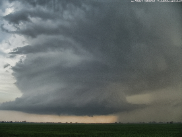
In the days leading up to the blizzard that struck the southern plains and midwest early this week, all the buzz was on different model forecasting sites that were spitting out impressive snow totals. The pretty colors and high totals had these images going viral minutes after they were released. The most common of which was likely WGN's RPM model run on Sunday afternoon which showed a staggering swath of 30"+ totals over northern Illinois and surrounding areas. It's a fairly well know fact that buying completely into these composite maps is simply naive, but just how accurate are they? They're generally posted with a "totals will be slightly less than this" disclaimer. I decided to save the model outputs from Earl Barker's WXcaster site in particular as it's one of the more commonly used models and does not seem to put out the outrageous totals that some in house model suites do for the days leading up to the blizzard in order to see how well the model rendered version of the NAM and GFS models did in the totals and placement of the heaviest totals.

On each map, the yellow shaded figures depict the actual measured storm total snow fall, overlaying the model forecast totals.

We'll start with the 12z GFS for Monday, the day before the storm:


It's hard to argue with this one. On a whole, the idea of taking the extreme totals and shaving a couple inches off seems to jive well with what the map shows. In addition, it handled the rain/snow cutoff line in the south fairly well. As expected, the northern extent of the heavier forecast swath didn't do quite as well. A northward shift in the system as it developed and moved through the area is partially to blame. From Iowa City, IA to Rockford, IL we see a lot of 9-12" totals in the red shaded areas that would have suggested totals surpassing 15". Then, take a look at the Kankakee area in northeast Illinois. I mentioned in my forecasts prior to the event that I expected both dry-slotting and a higher amount of precipitation falling in the form of sleet to cut down on totals along Interstate 57 in the Kankakee area which is exactly what transpired (pat on the shoulder for the Pritchard model!). This run of the GFS would have suggested in surplus of 20" of snow, where they really only experience about 30% of this forecast total. Dry-slotting is a hard to forecast, but crucial element to these powerful storms. A combination of dry-slotting during the evening, and a mix of precipitation types is also to blame for almost 50% reductions in forecast totals from Springfield to Bloomington, IL. The model at 36 hours in advance of the storm handled the overall southern transition line between liquid and frozen precipitation well, but did not handle the blend of sleet and snow well at all. This is probably the single most important reason to not buy into extremely high snow totals automatically. Ask yourself if they truly make sense, and what reasons other than a truly historic snowfall could be responsible for the model output.

Now, the 12z NAM forecast:

This model was on a whole, way too far south with it's heaviest snow totals swath. Again, it included the Interstate 72 corridor in 20" snow totals where in reality a blend of snow and sleet kept totals at only about 30% of this level. In fact, the entire eastern half of the heavy band in the forecast output fell victim to mixed bag precipitation types and dry-slotting as the storm moved into the area. The northern part of Illinois was significantly under forecast on this model run, which owes to the northerly shift in the system that neither the GFS or the NAM handled.

18z GFS Monday, the day before the storm:
The 18z GFS, oh those lovely off-hour forecasts that always seem to throw in some extreme variable to excite weather enthusiasts. Upper air sounding are only done twice a day under typical circumstances, at 12z and 0z. The 6z and 18z model suites have no new upper air data ingested, so falling for their every move isn't advisable. This particular off hour run of the GFS did not handle the southern line of the heaviest banding well at all. Areas along that St. Louis to Kankakee line are forecast to be along that southern line of totals in excess of 1 foot, but experienced prolonged periods of freezing rain and sleet. The northward shift and precip type difficulty again plaguing the model.

Now, we've got the 00z NAM for the night before the storm:
The most noticeable trend on the 00z output is the widespread reduction in snow totals. The path is on a whole unchanged, but totals have taken a significant hit. The biggest reason for this was the forecast increase in convection in the deep south near the Gulf Coast. Widespread convective storms were forecast to break out across the deep south (which did in a sense occur, but not to the extensive level forecast) which will commonly rob the conveyor belt of moisture from feeding into the low pressure system to the north and reduce snow totals. This is a legitimate concern that needs to be addressed even if the model run does not suggest it will be an issue. This was also the model run that spit out incredible 24-30" totals in the Oklahoma City area which went viral seconds after the model was released. I was immediately skeptical of the over-forecasting of snow totals due to mixed bag precipitation, which indeed turned out to be the case in most areas. The one thing this model did begin to handle well, was the enhanced snowfall accumulations near the Lake Michigan lake shore in Chicago.

12z Tuesday NAM from the day of the storm:
The morning of the storm, we see the models catch on to the northerly shift in the system track. Areas along Interstate 72 that I suggested would see a high amount of sleet and a high reduction in their snow totals are now beginning to be backed up by the model output. Without being too critical of the model's transition line forecast, 4-8" totals from St. Louis, MO to Danville, IL are on a whole fairly well handled. The yellow shading of the snow totals along this line clash with the colors a bit, but I assure you they're there and do jive with what the NAM suggested. Also notice that snow totals have increased dramatically again. The overall track of the heaviest band is well handled, but again, shaving 10% off the forecast total seems fair. The tan band from NE Missouri into the Chicago area suggesting 18-20" is spotted with totals that do fit in to that range. A few outliers are easily noticeable inside the band where totals on the order of only 13" or so occurred, and then 20"+ totals were found near Lake Michigan where lake effect snow occurred before and after the storm. The variations between actual totals in the heaviest areas were due to the model's inability to forecast where the heaviest mesoscale banding and embedded thunderstorms were to occur. Among precipitation type and dry-slotting, depicting areas that will experience the heaviest banding inside the deformation zone is something that a model of any resolution simply cannot forecast in advance. It can suggest a region where it is likely, as we see here, but getting down to fine resolution isn't going to happen.

And just for kicks, the 18z NAM from Tuesday, as the storm began impacting the area:
Most notable is the dramatic over-forecasting of totals in northeast Illinois from Kankakee southwest to just north of Champaign. The NAM, at even mere hours out still can not handle the fact that the dry-slot was already pushing in to southern Missouri taking aim on this area. I mentioned in my forecast discussion, as did many others forecasting the storm that portions of eastern and northeastern Illinois could see a lull in precipitation because of this, but it just is not something that forecast computer guidance has a good handle on. For what it's worth, the 4km WRF precipitation forecast model did try to handle this factor with relative success. Some over forecasting of totals is seen in eastern Iowa around Iowa City, which is likely due to the model suggesting inaccurately that mesoscale banding and heavy convective snows would set up in this area, which did not occur.

This isn't ground breaking evidence, as the difficulties that higher resolution models experience in forecasting snow accumulation were already commonly known but it's an interesting overlapping look at where the models seem to struggle the most. Exaggerated totals were common along the southern track of the heaviest forecast due to a tandem of inability to establish the crucial correct track of the center of low pressure, and the inability to distinguish precipitation type in high reflectivity zones where heavy freezing rain or sleet may be the dominant mode rather than obscene snow totals. Dry-slotting along the southern edge of the heavy forecast totals swatch is also another factor that the models commonly struggle with.

Ultimately these pretty colors are nothing more than that; pretty colors that can give a broad suggestion of the area that will see the heaviest totals, and how heavy these totals will be. Taking these specific totals as gospel is falling victim to meteorological cancer. Take this model suggestion, and pick it apart asking yourself if it makes sense given the above mentioned impacts.

Wednesday, February 2, 2011

Blizzard aftermath

Well, it's hard to give detailed photographic aftermath photos simply because it's impossible to gauge scale when it comes to drift height. I thought about sticking Tia out in some drifts, but thought better of myself and didn't ask. As much as she hates snowflakes in her eyeballs, I can't imagine she'd love snow up her pants. For hating winter so much, she and I made an awesome team digging out the driveway from waist and shoulder high drifts. I've never had to dig out from a snow of this magnitude, and it gave me an entirely new appreciation for my friends up north. It's a very helpless "where do you even start" feeling when you are standing in the middle of snow up to your waist, and it's all you can see around you. Okay shovel here, now where do you PUT it? Either way, we survived. After an exhausting exciting day yesterday watching the storm, and exhausting annoying day digging out today, I'm looking forward to doing -nothing- tomorrow. Northern Illinois University has already shut down for tomorrow as well, as temperatures will be dipping down to around -20F and they still need another day to finish digging out. I hope they pay those guys well, because it would take a lot to get me working in -20F air. I didn't sleep a lot yesterday so I wasn't dying to shovel out the drive today, but knew it wouldn't even be an option doing it tomorrow.

Anyway - I did take a quick walk around the neighborhood this morning to try and catch some of the aftermath. There wasn't a ton to shoot though... everything is pretty much just white.

This is looking out our unused door in the kitchen. I like the door indentations.

Back door.
This is our front porch / yard. Hard to give a sense of scale, but that ridge in the middle is probably waist or chest high. I had to guess where the steps were from the porch since it was drifted over, and guessed horribly wrong. Note my "step step SLIIIIDE" foot prints in the snow coming down.
Tia's car in the drive completely drifted in.

Found this unfortunate guy on my walk around the neighborhood.
Backyard.
Looking out the back door. My car may be brighter than the sun, but unfortunately it does not share it's warming properties.

No outdoor dinners in the backyard anytime soon. Darn, that's something I'm starting to miss doing right about now. Okay snow, hurry up and melt and let's start talking temperatures in the 60s again.


February 1 2011 Insane northern Illinois blizzard with gale force winds ...

Still getting very intense snowfall here in DeKalb, with perhaps hints that it will be continuing into the morning. Check out the 850 mb uvv chart for 6 AM tomorrow morning. That suggests fairly heavy convective snow bands across northeast Illinois. Plows have already ceased in the area and the interstates have been shut down. Planning on waking shortly after sunrise in hopes of shooting some aftermath photos before things get disturbed.


Photo from the center of Hwy 23 in DeKalb, completely covered in snow.


Tuesday, February 1, 2011

Thundersnow likely any moment...

Upper level low continues to rotate into northern Illinois bringing with it a band of very heavy snows and widespread thundersnow. Should be experiencing the worst of the storm within the hour, right on with my 9 PM forecast. Check the live stream!

Click here for the live stream!


I'm heading out now to see what I can get video wise. Heading out on foot, of course... not that I could get my car out if I tried. Not sure who these people are that are still out driving around.

Northern Illinois blizzard update! Feb 1 2011

Lake effect snow has taken full force reducing visibility to under 1/2 mile in DeKalb County in northern Illinois. Snowfall rates are approaching 3/4" per hour, and this is not even "system snow" related to the main snow complex moving toward the region, though it is indirectly caused by the strong easterlies off the lake right now. It's fairly uncommon to see lake effect snow reach as far inland as DeKalb, but with a 70-80 knot low level jet we're having no problem at this point.


Check out the forecast track of the 850 mb low across central Illinois. Northern Illinois is set to get absolutely creamed in about 6-12 hours. The northern edge of the heavy snow is already approaching Interstate 88, with strong easterlies still off Lake Michigan lake enhancement is very possible. The next 12 hours are going to be a blast, and I'm not even a winter weather lover.

Live Stream

Alright, since it takes minimal effort on my end I've decided to throw a live stream up of the impending blizzard here in DeKalb, IL. I won't be around the entire time so if it goes down, it goes down. I'm hoping to send in updates via mobile if things do get bad. As it stands, still holding tight to my 15" prediction for DeKalb and Northern Illinois University. Getting light to moderate lake effect snow already, with the main system still off to our south.

You can find my live stream on this page by clicking on my icon in northern Illinois.

http://chase.tornadovideos.net/pages/full_screen