
Well, I'll be all alone, but I'm heading to eastern Missouri today. My forecast is still honestly unchanged as of my thinking 60 hours ago. I could very well end up either socked in with clouds or in a subsidence filled environment where nothing fires.
However, things are clearing out now and I fully expect to see severe storms erupt in central Missouri and move eastward thru the afternoon, some of which could produce a couple tornadoes. My target remains the Columbia area early, and then progressing towards Quincy to St. Louis as the evening approaches.
Dying remnants from convection in the plains are now approaching western Missouri. This, associated with the powerful wave ejecting into central Missouri by afternoon moving into an increasingly unstable airmass filled with beautiful looping hodographs leads me to believe we'll see a few supercells. I'm leaving Champaign in a half hour attempting to be in eastern Missouri by around 2 or 3.
Friday, April 23, 2010

Thursday, April 22, 2010
Friday Potential Update
My forecast is almost identical to the one I made yesterday concerning this matter.
I seem to be the only one, but I'm still very confident in a couple tornado warned storms and likely a couple tornadoes in eastern Missouri and possibly western/southwestern Illinois tomorrow afternoon and evening. Still looking at my target from yesterday as Columbia to St. Louis to Quincy.
Stratiform precip along the warm front should slow the warm front down a bit, but I believe it will lift to around Chillicothe MO to St. Louis by early afternoon. Ideally some clearing will allow for rapid destabilization ahead of the shortwave punching out from the plains which will be entering central MO by early afternoon. The remnants of the wave from the plains should be entering Missouri around that time with the shortwave, possible in the form of an MCV. Just ahead of this wave and along the warm front is where I would want to be, which should set up in my target triangle.
Perhaps I'll be the only stupid chaser in this area busting under rain showers, but I'm pretty confident in a couple supercells at this point.
I seem to be the only one, but I'm still very confident in a couple tornado warned storms and likely a couple tornadoes in eastern Missouri and possibly western/southwestern Illinois tomorrow afternoon and evening. Still looking at my target from yesterday as Columbia to St. Louis to Quincy.
Stratiform precip along the warm front should slow the warm front down a bit, but I believe it will lift to around Chillicothe MO to St. Louis by early afternoon. Ideally some clearing will allow for rapid destabilization ahead of the shortwave punching out from the plains which will be entering central MO by early afternoon. The remnants of the wave from the plains should be entering Missouri around that time with the shortwave, possible in the form of an MCV. Just ahead of this wave and along the warm front is where I would want to be, which should set up in my target triangle.
Perhaps I'll be the only stupid chaser in this area busting under rain showers, but I'm pretty confident in a couple supercells at this point.
Wednesday, April 21, 2010
Friday Tornado Potential
I'm becoming increasingly confident in a few tornadoes occurring in far NE Missouri, and possibly western Illinois into the evening hours. Target at 60 hours out would be in a region bounded by Quincy to Columbia to St. Louis. This is very chaseable terrain and road wise.
Vorticity maximum and associated 500 jet max will be screaming into central Missouri by noon. This, coupled with impressive 0-3km cape values and sbcape values around 1000-1500 j/kg should lead to the initiation of robust convection by mid-afternoon. Incredible looped hodographs in the vicinity of the warm front will be more than favorable for rotating storms, possibly minisupercells that should be more than capable of producing tornadoes. The cap should be pretty weak, so my main concern at this point is too much early convection associated with the speed max too early in the day. Obviously another question as always will be the amount of destabilization that occurs, which goes hand in hand with the potential issue of too much early convection.
It would be really hard for me to turn down a hodograph like this however, if it appears destabilization appears likely. Time sensitive link valid until Tuesday night.
http://beta.wxcaster.com/cgi-bin/par...STATIONID=kuin
At this point however, I think the NE quadrant of Missouri bears close watching, perhaps stretching into western Illinois during the late evening.
The other obvious target is in eastern Nebraska right now. The obvious issue with this area is the flow at H5. The stronger jet max is punching into Missouri during the evening leaving Nebraska under fairly weak and southerly flow. Strongly backed flow at 850 could compensate for this however and be sufficient for a few tornado reports. My main concern in this area is that the show ends up being more of a QLCS event quickly as convection becomes widespread. Severe weather is an almost sure thing in this area, but the flow at H5 is what is potentially keeping is from being a bigger tornado producer. Lincoln, NE would be a good starting point for this target. Maybe a hair north of that.
Here's a quick google map image of my tentative target region at 60 hours out for April 23 2010.
View April 23 2010 Threat Area in a larger map
Vorticity maximum and associated 500 jet max will be screaming into central Missouri by noon. This, coupled with impressive 0-3km cape values and sbcape values around 1000-1500 j/kg should lead to the initiation of robust convection by mid-afternoon. Incredible looped hodographs in the vicinity of the warm front will be more than favorable for rotating storms, possibly minisupercells that should be more than capable of producing tornadoes. The cap should be pretty weak, so my main concern at this point is too much early convection associated with the speed max too early in the day. Obviously another question as always will be the amount of destabilization that occurs, which goes hand in hand with the potential issue of too much early convection.
It would be really hard for me to turn down a hodograph like this however, if it appears destabilization appears likely. Time sensitive link valid until Tuesday night.
http://beta.wxcaster.com/cgi-bin/par...STATIONID=kuin
At this point however, I think the NE quadrant of Missouri bears close watching, perhaps stretching into western Illinois during the late evening.
The other obvious target is in eastern Nebraska right now. The obvious issue with this area is the flow at H5. The stronger jet max is punching into Missouri during the evening leaving Nebraska under fairly weak and southerly flow. Strongly backed flow at 850 could compensate for this however and be sufficient for a few tornado reports. My main concern in this area is that the show ends up being more of a QLCS event quickly as convection becomes widespread. Severe weather is an almost sure thing in this area, but the flow at H5 is what is potentially keeping is from being a bigger tornado producer. Lincoln, NE would be a good starting point for this target. Maybe a hair north of that.
Here's a quick google map image of my tentative target region at 60 hours out for April 23 2010.
View April 23 2010 Threat Area in a larger map
Thursday, April 15, 2010
More Shabonna
Same stuff, different day.
Cubs lost this time, but other than that the day was identical. Walked a new trail in the forest preserve section today, but ultimately ended the day back at the lake. Barely made it back to my car before dark actually, which would have been interesting.


Cubs lost this time, but other than that the day was identical. Walked a new trail in the forest preserve section today, but ultimately ended the day back at the lake. Barely made it back to my car before dark actually, which would have been interesting.

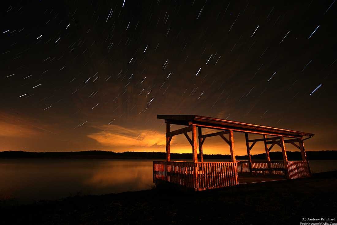
Evening at Lake Shabonna
Just wrapped up a pretty excellent evening at Lake Shabonna in southern DeKalb County. The afternoon began with a Chicago Cubs thriller ending in a come back win for the good guys. After that, sunny skies, temperatures in the 80's and nothing on the agenda meant only one thing. I needed to get out of the house. Tia and I had planned on heading to Lake Shabonna together to explore the area. She got stuck with a group project for the remainder of the week so I had to solo it. It was the first time since discovering the place that I was able to actually get out and look around, so I decided to follow one of the trails. It turned out to be pretty epic! I began walking around 5:30, and didn't return to my car until dark and I didn't even walk the entire thing.
I managed to see countless deer, a raccoon, a skunk, a snake, five beavers (one of which being incredibly cliche' and chewing on some wood as it swam along with the others) and a ton of hawks. And swarms of those annoying little gnat type things that just fly furiously in compact swarms, and apparently follow people around. They'd latch on and just fly in a pack right above my head. Perhaps my friend Google can help me out... be right back. Eh, some kind of gnat. But you walk under one of their swarms and they literally follow you. I had several packs latch on to me and had to sprint to leave them behind.
By dusk I returned to my car and drove to a new spot to setup for star trails. I spent about an hour out there but bumped the camera midway thru so the trails aren't nearly as long as I had hoped.
I'm suddenly not in the mood to write. I'll likely try and head back out tomorrow evening as I'm fairly free again. This has actually been a pretty docile end to the semester for once. I'm fairly free until actual finals week arrives, which will be the first week of May.
My sensor needs cleaned, and I didn't notice I had dried on raindrops from the lightning expedition last week that helped screw with a couple photos.
Flickr if you want to avoid blogger compression:
http://www.flickr.com/photos/prairiestormmedia/sets/72157623858213536/


Here's mister little garter snake. Going to get flattened if he isn't careful, but I'm sure that warm pavement felt awesome.


I managed to see countless deer, a raccoon, a skunk, a snake, five beavers (one of which being incredibly cliche' and chewing on some wood as it swam along with the others) and a ton of hawks. And swarms of those annoying little gnat type things that just fly furiously in compact swarms, and apparently follow people around. They'd latch on and just fly in a pack right above my head. Perhaps my friend Google can help me out... be right back. Eh, some kind of gnat. But you walk under one of their swarms and they literally follow you. I had several packs latch on to me and had to sprint to leave them behind.
By dusk I returned to my car and drove to a new spot to setup for star trails. I spent about an hour out there but bumped the camera midway thru so the trails aren't nearly as long as I had hoped.
I'm suddenly not in the mood to write. I'll likely try and head back out tomorrow evening as I'm fairly free again. This has actually been a pretty docile end to the semester for once. I'm fairly free until actual finals week arrives, which will be the first week of May.
My sensor needs cleaned, and I didn't notice I had dried on raindrops from the lightning expedition last week that helped screw with a couple photos.
Flickr if you want to avoid blogger compression:
http://www.flickr.com/photos/prairiestormmedia/sets/72157623858213536/


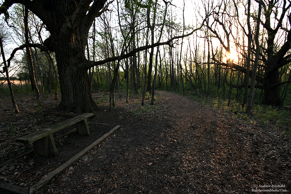


Here's mister little garter snake. Going to get flattened if he isn't careful, but I'm sure that warm pavement felt awesome.

Wednesday, April 7, 2010
Tuesday's Bust
Well, I said I'd be writing about what went wrong yesterday and to that I will remain true. I left in hopes that the warm front would compensate for the southwest flow at 850 mb. That did not happen. Instead my fears came true and south of the warm front was a linear mess, and along the warm front where a storm went supercellular it was outflow dominant almost right away. A wall cloud was seen, and a funnel cloud reported early in it's life, however by the time it reached Highway 30 not an hour into it's life the storm had a big sweeping gust front and tons of rolling scud with cold outflow. I was with Scott Weberpal most of the chase, and when repositioning on the storm we stepped out of our vehicles and immediately he said "cold outflow." and I knew we were in trouble. I pulled up radar to see what our options were as far as dropping south and intercepting a new storm and saw a solid line of convection to our south and knew right then the chase was likely done. Our only option, we both hopped back on Highway 30 and began flying east to keep up with the outflow dominant supercell. I was able to film some fun motions in some scud fingers that did end up twisting into rows of scud funnels, but that was the only rotation I would see this day. A slow oversize load prevented us from ever getting back ahead of the storm. I broke off the chase in Cedar Rapids and plotted my course back home. I suppose I can be happy that Iowa let me leave with my car this time.
Looking into the future, I see nothing to get excited about. A pseudo active period will continue, but the majority seem to be fast moving poorly aligned systems with little moisture to work with. I think it's safe to say I won't be chasing anything decent until at least the end of April. I hope that's not the case, but my hopes are low at this point.
Below are a couple shots from yesterday. The first being the tornado warned (though, not tornado warned anymore) supercell as seen from Highway 30 as it raced towards Cedar Rapids. The following photo is of the ever excited Scott Weberpal, looking very optimistic as we await storm maturation to our south.


You know, normally with 3.5 weeks of classes remaining now in mid-April I'd be really excited about finishing up so I can spend my time worrying about chasing tornadoes. This year though, after a garbage filled 2009, and a cap bust and an Iowa outflow bust to start 2010 for me I'm almost ready to just say 'see ya' and head up to the lake in Wisconsin and relax. Of course I would never actually be able to look the other way when it comes to severe weather, but it's really rubbing me the wrong way lately! Tia and I actually have plans to spend a lot of the late spring and summer taking adventures to random state parks and other outdoorsy type things. There are so many state parks, lakes, hiking areas that most people never really think twice about but this year I want to try and hit up a bunch of new places. Back in Urbana we'd spend a lot of nicer days hitting up Homer Lake in Champaign County, which has a nice set of winding trails wrapping through the woods surrounding a beautiful lake.
Tia enjoying the sights at our last walk through Homer Lake last spring:

It really is a nice place, but I feel the need to expand my horizons. I already want to plan a couple camping trips up to Wisconsin in May with my partner in crime, before I normally would head up there. Being up north, the lake water is still a little chilly in May so I figured perhaps we could take a weekend up there and spend the days checking out a few of the other lakes/forested areas up there. Even though we've got a cabin (really more of a house, but it's more summer-y to call a cabin) I want to bring up a tent and rough it.
I'm antsy for the next legit severe weather threat to the nations mid-section, but I'm hoping to get a lot more out of this May and June than I otherwise would. I will still have a lot of time off during the time, but rather than taking 2-3 straight weeks strictly chasing, I'll likely just chase the setups as mother nature provides, and then spend the down time roughing it in the woods with the girl. (I'm proofreading this now, and just realized what I just said in that last sentence, but I think I'm going to let it stand.)
I really meant to just post a quick disgruntled "Iowa sucks." chase reports for yesterday but again got myself off on a little tangent and am in a much more optimistic mood now. That is of course until the sun rises tomorrow and I step outside to realize a cold front has moved through and sunny skies and 80 degrees are in the past for now.
Although, check out this map issued by the Climate Prediction Center. I'm not sure what they saw, as it doesn't look -that- warm to me, but we'll hope they're on to something.

Tuesday, April 6, 2010
Sitting in eastern Iowa...
Currently sitting east of Tama, Iowa just off of Highway 30 in east central Iowa awaiting initiation. Looks like a good chance for tornadoes today if you can get a storm to latch on to the warm front for any amount of time. Areas south along the dryline in southern Iowa and into Missouri do not interest me at all. Those back at home in northern Illinois might even keep an eye on the warm front over there. I know how these things like to pull funny business on that side of the Mississippi. I would not be surprised to see a good storm or two near Interstate 80 in northern Illinois.
My game should initiate around Des Moines right now. The game today is to never let the warm front get out of my sight. Too often I tell myself I will do that, but an appetizing storm on radar to the south will lure me down away from the front and never produce beyond being a pretty storm on radar, while the ugly storm on radar goes nuts on the warm front. It's all about knowing your environment on a day like today; not picking the strongest storm off the radar screen.
Looks like anywhere along the Highway 30 corridor today, but I think the area around Tama/Toledo to Cedar Rapids warrants special attention. It is Iowa, so I know that in 12 hours I will be writing about what ingredient was missing, or what I did wrong but as far as Iowa goes I'm liking my odds at ending the curse, and ending my drought.
I see Scott Weberpal approaching in the distance, so I'll wrap this up.
My game should initiate around Des Moines right now. The game today is to never let the warm front get out of my sight. Too often I tell myself I will do that, but an appetizing storm on radar to the south will lure me down away from the front and never produce beyond being a pretty storm on radar, while the ugly storm on radar goes nuts on the warm front. It's all about knowing your environment on a day like today; not picking the strongest storm off the radar screen.
Looks like anywhere along the Highway 30 corridor today, but I think the area around Tama/Toledo to Cedar Rapids warrants special attention. It is Iowa, so I know that in 12 hours I will be writing about what ingredient was missing, or what I did wrong but as far as Iowa goes I'm liking my odds at ending the curse, and ending my drought.
I see Scott Weberpal approaching in the distance, so I'll wrap this up.
Monday, April 5, 2010
Chasing Today
Again, no time for a big drawn out forecast but I'm likely chasing today. I'm eyeing a "sleeper" target further east from the main warm front target in SW Iowa and NW Missouri. I hope all the chasers in the world go over there, and I do wish them luck but at the same time am eyeing a target that I think is very underrated and will hopefully be free of the chaser hoards.
Ottumwa, IA to Havana, IL. I think this area needs watched very closely. Warm front is very sharp and defined on the RUC and has surface winds almost easterly along the warm front. If something goes here, the shear is outrageous. EML will be a lot easier to overcome further east as well.
Ottumwa, IA to Havana, IL. I think this area needs watched very closely. Warm front is very sharp and defined on the RUC and has surface winds almost easterly along the warm front. If something goes here, the shear is outrageous. EML will be a lot easier to overcome further east as well.
Lightning Tonight
I didn't "chase" today, but intercepted the severe warned cell near Bloomington, IL around 9 PM. I ended up sticking to Easter commitments, but needed to return to northern Illinois tonight so I plotted my departure to coincide with the line reaching the Interstate 39 corridor. I ended up intercepting the formerly tornado warned cell from the Peoria area that I believe a few people were on. The cell was severe warned at my intercepting time, but I only reported pea sized hail and 35 mph winds. I managed a few decent lightning shots as the storm entered Leroy, Illinois.


As for tomorrow, southern Iowa or bust. Or maybe northern Missouri I guess. I don't know what to think. In some aspects it looks amazing. In others, I don't know if a storm is going to form or not. Can I take that risk though with such a primed environment. Add to that I can not leave DeKalb until 11 am. My current ball park target it Lamoni, Iowa. Leaving at 11 puts me in Lamoni at about 4:30-5. I suppose that is doable, but is also a scary time for an ETA to a target area. I guess I just like being really early. It would just be fantastic if the warm front would fire further east into southeast Iowa, but could I be so lucky? Luck is not something that exists once I cross that border into that dreadful state.
Not going to write a forecast out for tonight as I am pressed for time and need to get to bed. I will try and update in the morning, but for now think Lamoni, Iowa.


As for tomorrow, southern Iowa or bust. Or maybe northern Missouri I guess. I don't know what to think. In some aspects it looks amazing. In others, I don't know if a storm is going to form or not. Can I take that risk though with such a primed environment. Add to that I can not leave DeKalb until 11 am. My current ball park target it Lamoni, Iowa. Leaving at 11 puts me in Lamoni at about 4:30-5. I suppose that is doable, but is also a scary time for an ETA to a target area. I guess I just like being really early. It would just be fantastic if the warm front would fire further east into southeast Iowa, but could I be so lucky? Luck is not something that exists once I cross that border into that dreadful state.
Not going to write a forecast out for tonight as I am pressed for time and need to get to bed. I will try and update in the morning, but for now think Lamoni, Iowa.
Friday, April 2, 2010
Quick update before the holiday
I'm heading back to Champaign-Urbana for the holiday weekend and won't likely be on the computer much so just throwing a quick update out there before doing so. Next weekends system is getting closer, and more and more clear. Still holding onto Tuesday being the more widespread severe day of the week. Looks like a typical early season moderate to high risk day over Iowa and Missouri with fast moving line segments and supercells. It could be a good tornado event, but may pose chasing issues with storm speeds. The terrain should be doable though, so I could see a few chasers having excellent days on Tuesday April 6th.
Monday showing some warm front potential. I'm still not sold on the Kansas tornado probs yet, as there are some phasing issues. The only play I see in that area is going to be right on the triple point. More importantly, I think a tornado potential needs to be watched further east along the warm front into the Missouri and Iowa borders. Adequate instability, incredible hodographs and stronger low level winds look to setup in that area. Whether the juice is there remains to be seen, but at this rate the Iowa and Missouri border is where I would watch for Monday afternoon and evening. I could be sold on Kansas down the road, but I am not yet.
Things really get cranking after that as the low deepens near Omaha during the first half of Tuesday. I've pretty well laid out my thoughts on that day already. The day is still not garnering that much attention, but I'm confident it will soon. It's 4-5 days out yet, but I'm willing to bet it's the first moderate to high risk tornado prob of the year, likely encompassing Iowa and Missouri.
One could probably sit on Interstate 35 on the IA/MO border and be fine both days to start off.
That said, Happy Easter everyone... I hope travels are safe and times are good!
Monday showing some warm front potential. I'm still not sold on the Kansas tornado probs yet, as there are some phasing issues. The only play I see in that area is going to be right on the triple point. More importantly, I think a tornado potential needs to be watched further east along the warm front into the Missouri and Iowa borders. Adequate instability, incredible hodographs and stronger low level winds look to setup in that area. Whether the juice is there remains to be seen, but at this rate the Iowa and Missouri border is where I would watch for Monday afternoon and evening. I could be sold on Kansas down the road, but I am not yet.
Things really get cranking after that as the low deepens near Omaha during the first half of Tuesday. I've pretty well laid out my thoughts on that day already. The day is still not garnering that much attention, but I'm confident it will soon. It's 4-5 days out yet, but I'm willing to bet it's the first moderate to high risk tornado prob of the year, likely encompassing Iowa and Missouri.
One could probably sit on Interstate 35 on the IA/MO border and be fine both days to start off.
That said, Happy Easter everyone... I hope travels are safe and times are good!
Subscribe to:
Posts (Atom)


 Posts
Posts


