
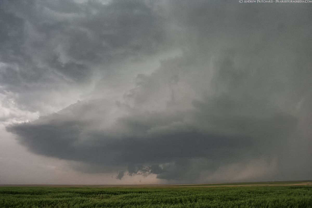
The first storm we intercepted north of Dodge City looked like it wanted to do it for a very long time, but remained in a quasi-HP form early in its life producing a rain wrapped tornado. It was apparent a tornado was on going (minutes after this photo) but we didn't get a view until the entire mesocyclone occluded revealing a choked off mesocyclone with dancing vortices underneath only for a few seconds.
This photo shows the intense supercell moments before it produced the rain wrapped tornado to our south. I invite you to check out our "main event" as we experienced 80-100 mph winds in the RFD to another supercell later in the evening.


No comments:
Post a Comment